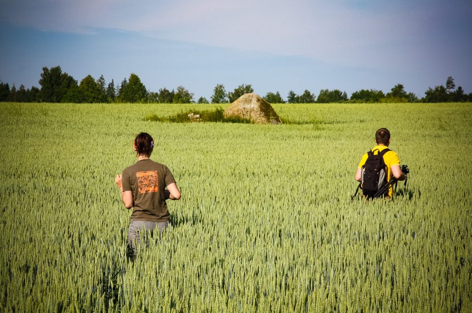
About 600 m south-east of the Lejas Murēni homestead, about 600 m north-west of the Jeri farm and homestead, in a cornfield.
About 600 m south-east of the Lejas Murēni homestead, about 600 m north-west of the Jeri farm and homestead, in a cornfield.
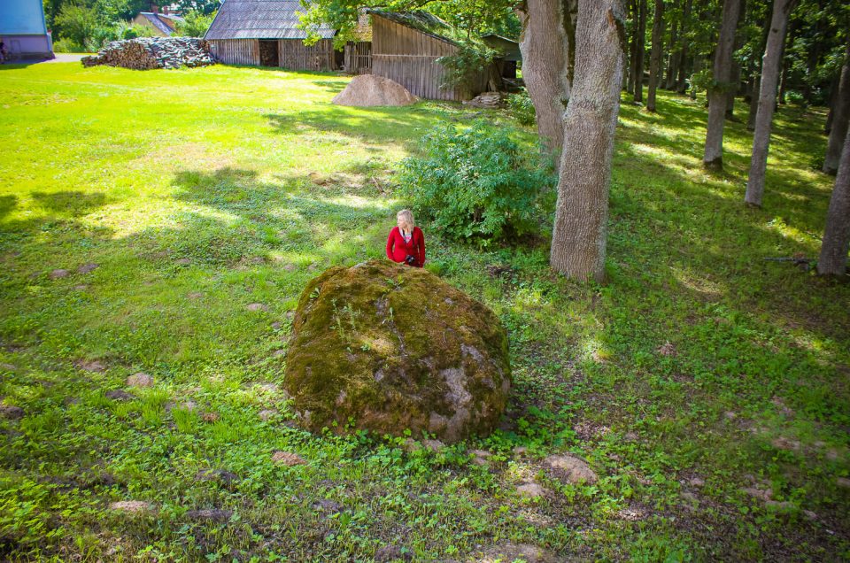
The stone is located 100 m direction N from Zasa School, 20 m from the new sports hall, aside of the park, in a well-managed area.
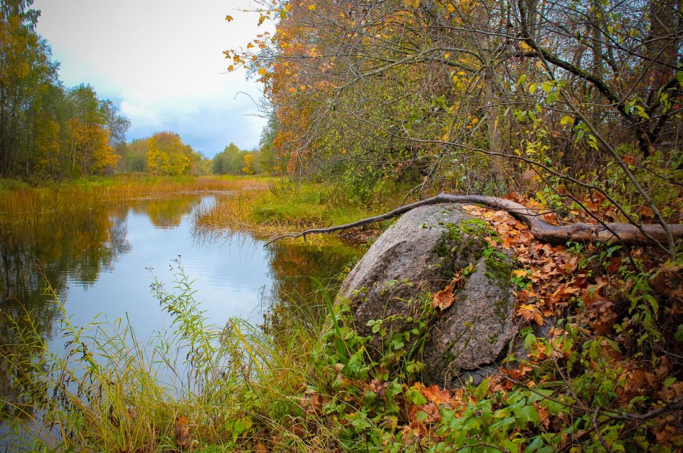
On the right bank of the River Suseja, near Plani. 130 m of the Vecumnieki – Nereta road, 50 m downstream a sharp river turn.
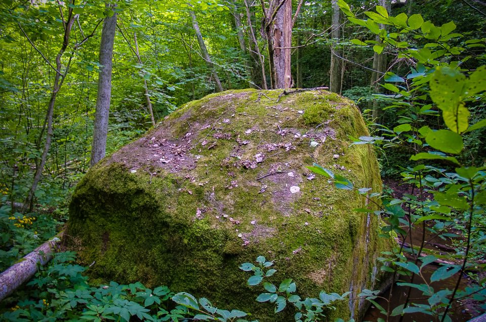
The Zāģeri Devil’s Stone lies 3 km S-SW (in a straight line) from Kalnamuiža, in a wild and deciduous tree-covered side ravine of the right bank of the Amula River, about 300–400 m SE of the uninhabited Zāģeri homestead.
Between the Vosvi and Šķepasti, 1.5 km S from the Druski Hill Fort, on the E coast of the Klotiņi Lake, 200 m NW from the Vosvi homestead.
