Location
State: Latvia
Region: Zemgale
County: Jaunjelgavas
Parish: Staburaga
Other references to the location
In Petersala forest, around 500m from the former “Mezziedi” home and the small River Oklupite. 20 m direction W from a forest road, which leads direction S from the former “Mezziedi” home.
Coordinates
lat=56.5563888889, lon=25.4658333333
56° 33′ 23″ N, 25° 27′ 56″ E
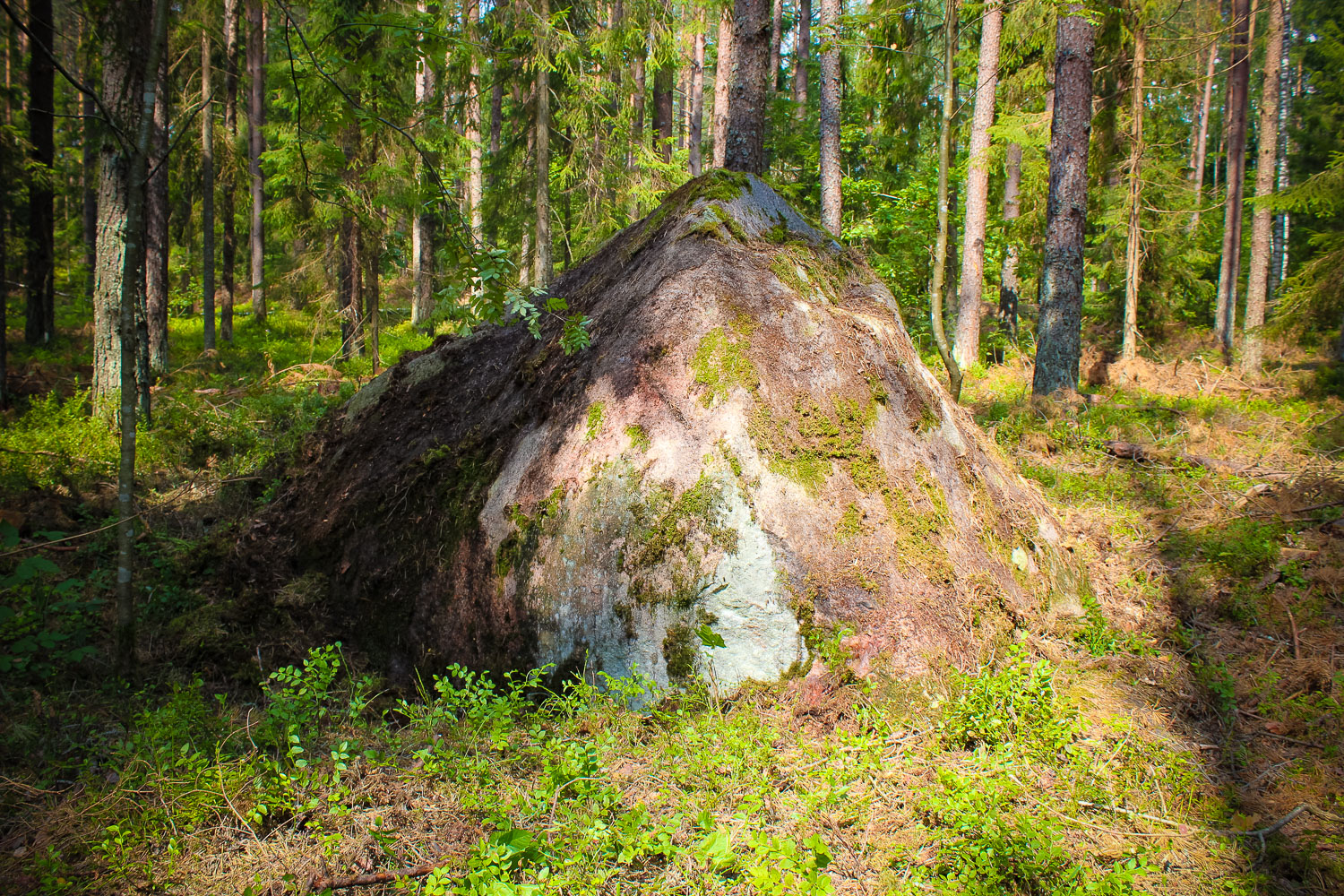
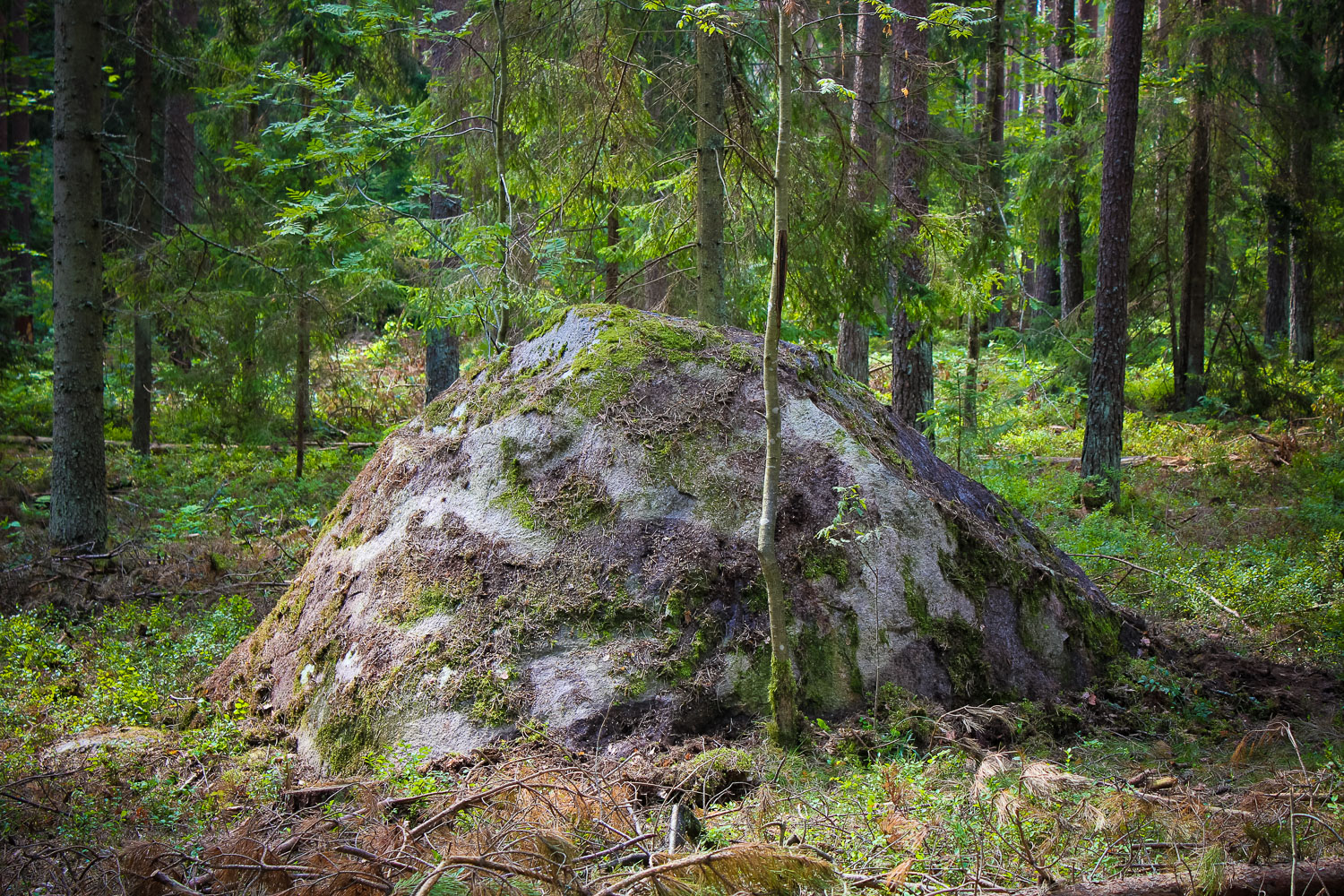
Description
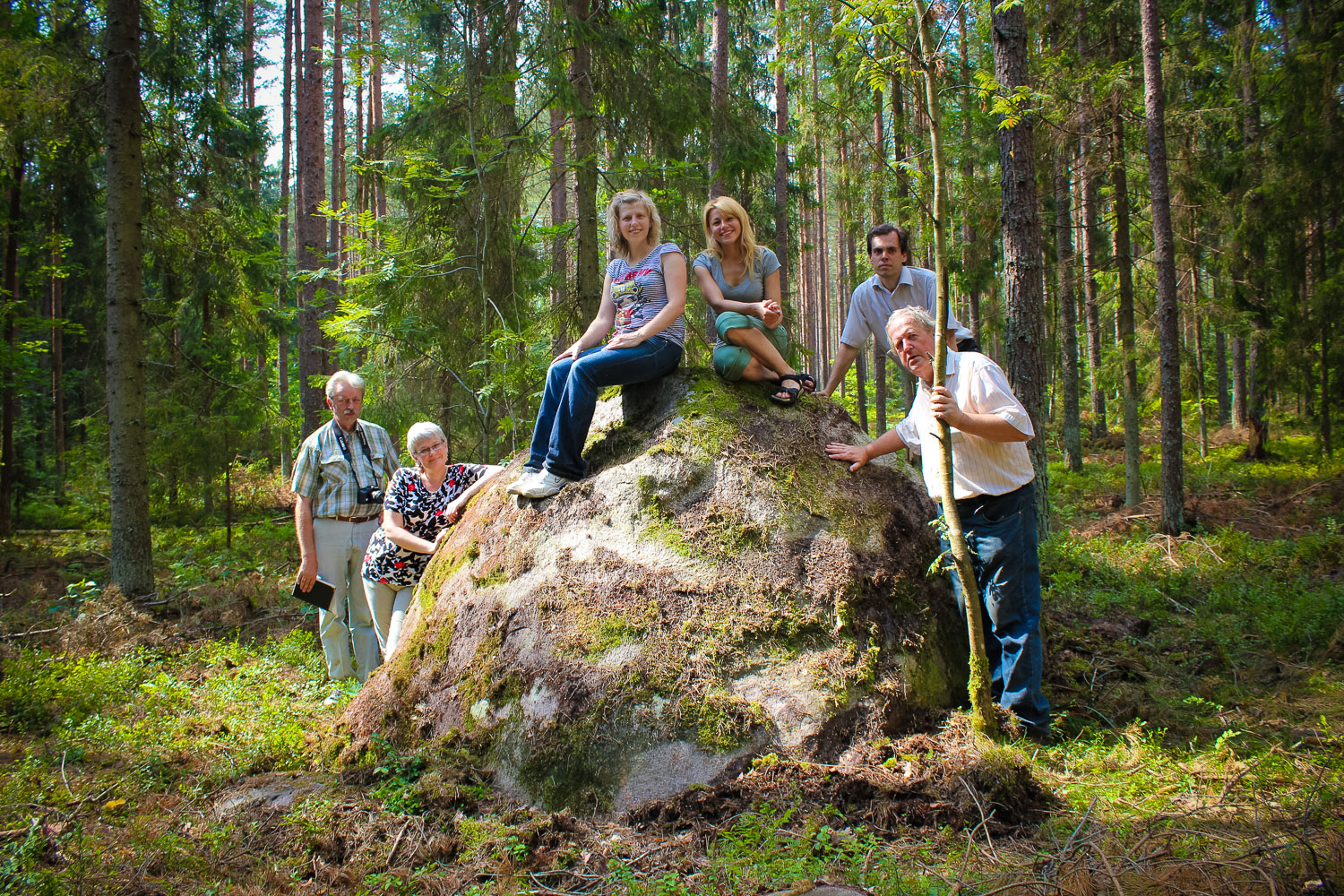
Dimensions above ground: 4,3 x 2,6 x 2,2 m, maximum height has been measured in the pit – 2,5 m, circumference 11,60m. On the E side there are two stairs, created naturally by means of shivers from the stone, while on its surface there is a small hollow (0,4 x 0,15 m). Medium-grained granite-gneiss.
Narrative
It is said the stone had been left behind by the Devil, who had went looking for a suitable place for his house. In the 1960ties initial archaeological excavations had been carried out near the stone. On the S and SW side of the stone now overgrown dug-up ground is seen.
Attraction
Well-shaped. In a neat forest.
Availability
Rather hard to find.
Infrastructure, management, facilities
No tourism infrastructure. Nearest town – Aizkraukle, where shops, accommodation and catering sites are found. Remarkable sightseeing objects in Aizkraukle – water power-station, museum “Kalna ziedi”, where also the remains of the castle mound and th
Local info
No information.
Capacity
10 – 40
Publicity
Known
Legal Status
Private
Comments
Reference document: Cepitis Janis. Heritage stones of the Ancient Selonia. // published by “Vides vestis”, p. 22-23; Jakubenoka Lilija. Mythological stones in legends and observations on the left bank of the River Daugava.// “Daugavas raksti”, Riga, 2000; Jakubenoka L. Mythical landscapes and nature objects on the banks of the River Daugava in Aizkraukle district, 2007.