Location
State: Latvia
Region: Kurzeme
County: Grobiņa
Parish: Medze
Other references to the location
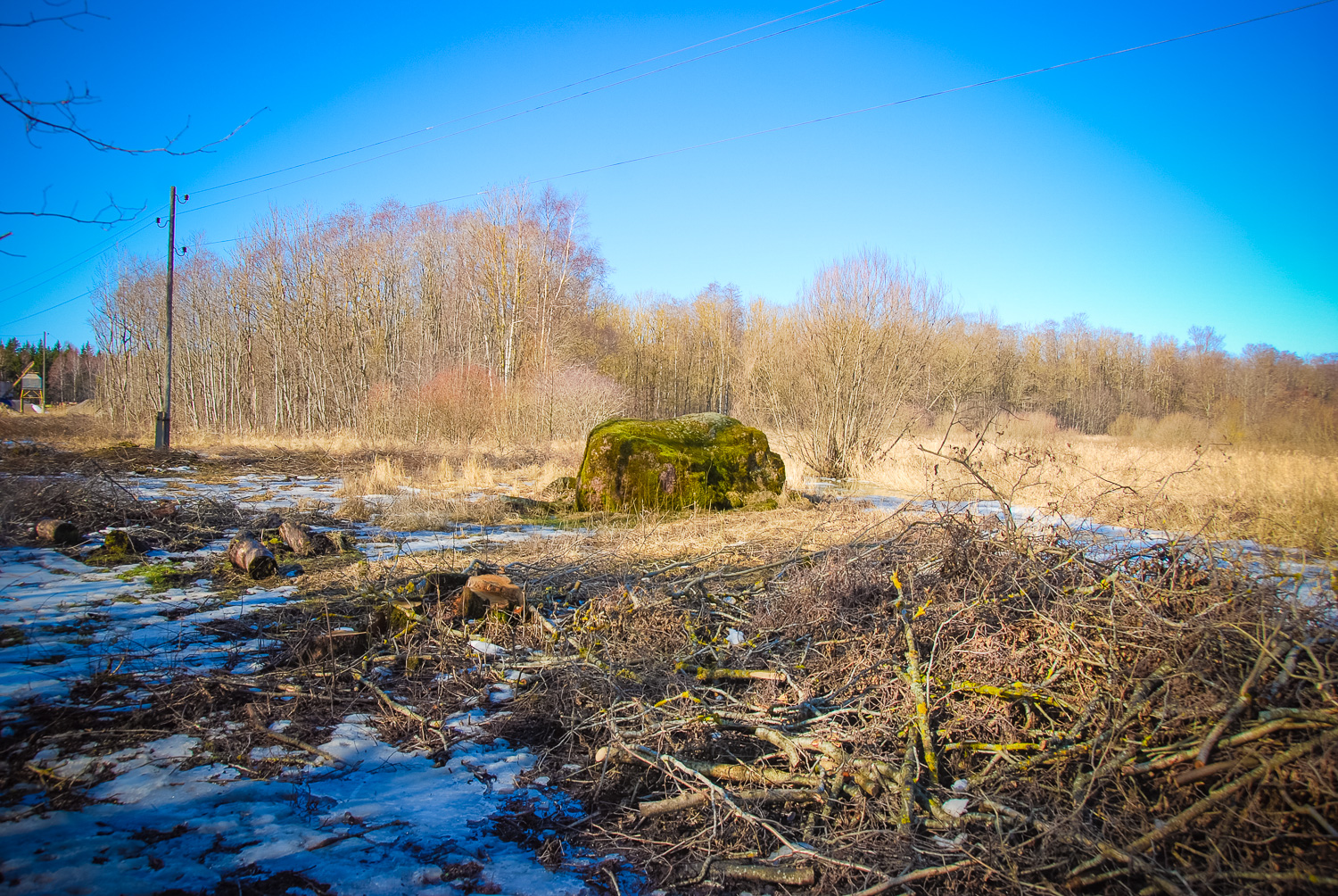
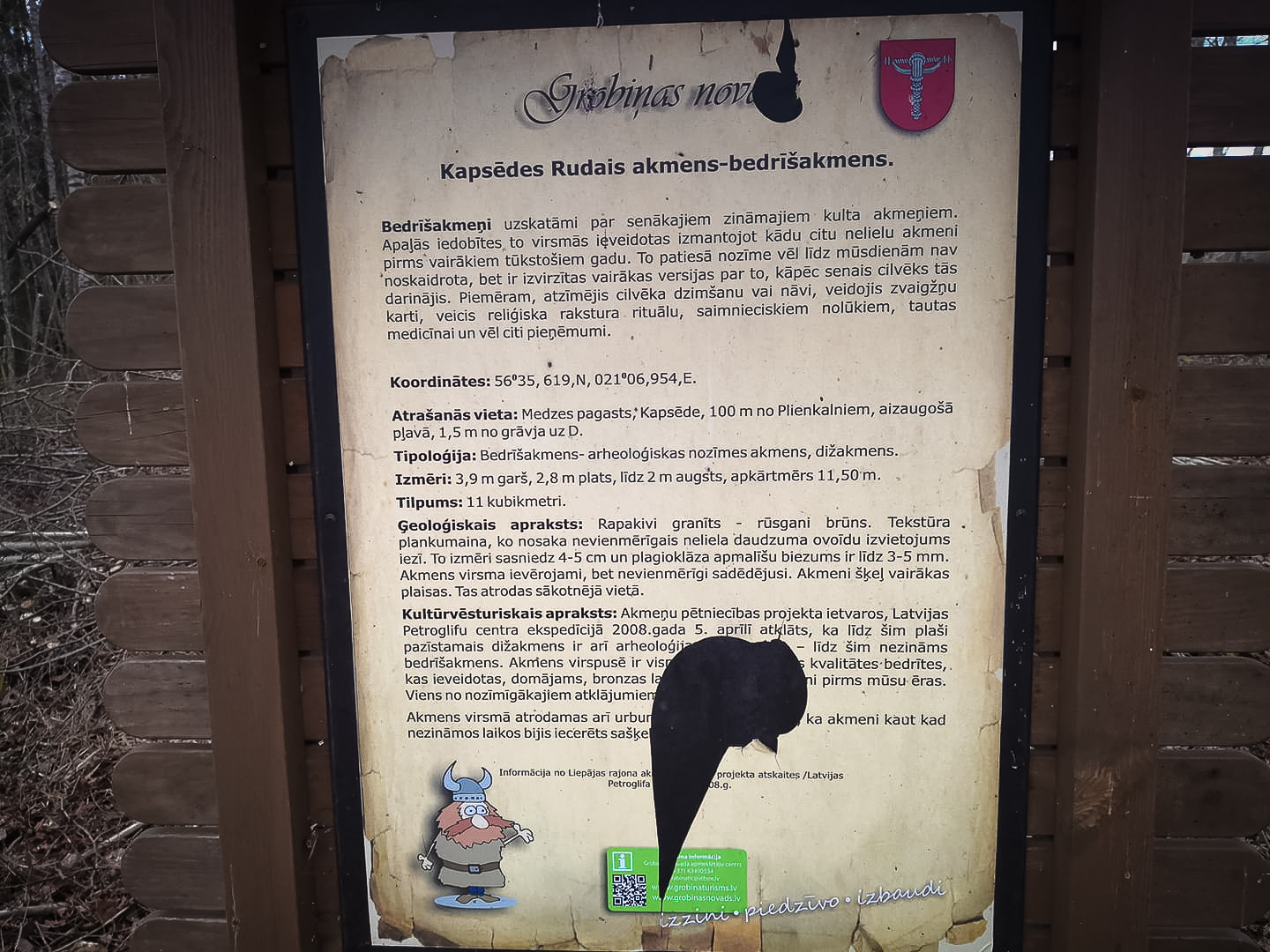
In the surroundings of Kapsēde, 100 m from Plienkalni, in an overgrown meadow, 1.5 m S from the ditch, directly under the electric line, not far from the forest edge.
Coordinates
lat=56.59365, lon=21.1159
56° 35′ 37″ N, 21° 6′ 57″ E
Description
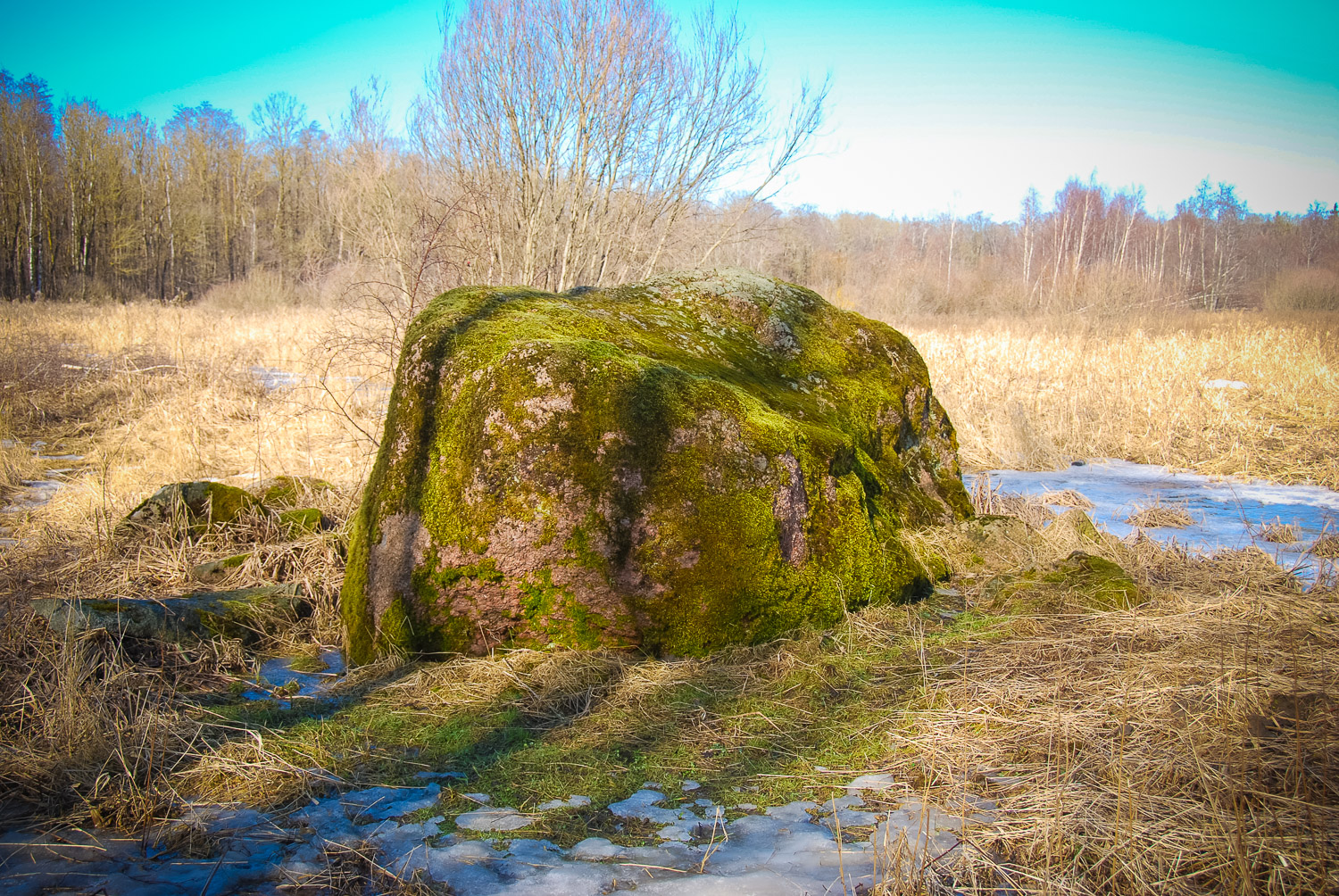
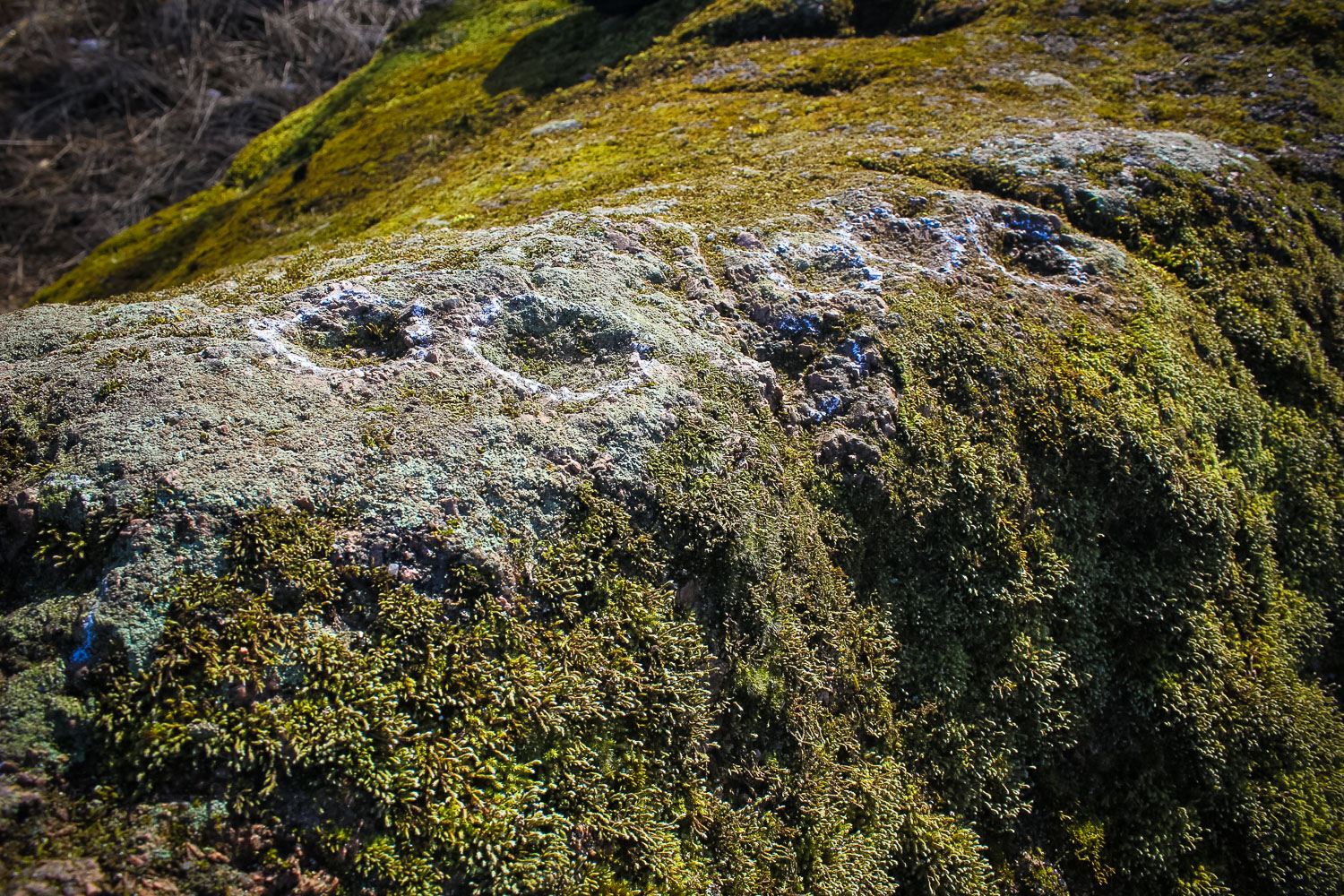
A cup-marked stone, stone of archaeological significance, secular stone. Dimensions: length 3.9 m, width 2.8 m, height up to 2 m, circumference 11.50 m, volume 11 m3. Rapakivi granite —russet brown. A protected archaeological site since year 1957. The russet stone was explored and described by K. Grēvinks already in 1861.
Narrative
On the stone surface there are at least 7 convincing quality cup marks which most likely were created in the bronze age, i.e., considerably before the Christ.
Attraction
Excellent
Availability
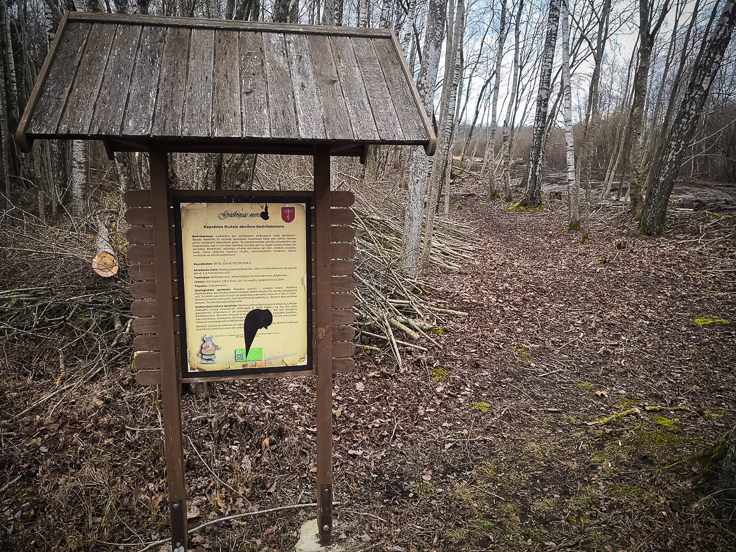
Easily accessible. There are information signs. Accessible along a small forest path, 100 m from the Plienkalni homestead in an overgrown meadow. During wet weather appropriate footwear is needed.
Infrastructure, management, facilities
There is an information sign.
Local info
There is no information stand on site. There is information stand on site. (22.01.2020.)
Capacity
10 – 40
Publicity
Popular
Legal Status
Private