Kalnalammikas Sacrificial Stone and Settlement
Location
State: Latvia
Region: Vidzeme
County: Rūjiena
Parish: Lode
Other references to the location
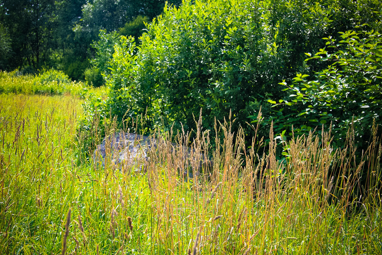
Short a kilometre north from the centre of Lode. The Kalnalammikas homestead is situated on the right bank of the Rūja River. The stone is at the edge of the Rūja flood land, approximately 100 m S from the homestead.
Coordinates
lat=58.0255555556, lon=25.3836111111
58° 1′ 32″ N, 25° 23′ 0″ E
Description
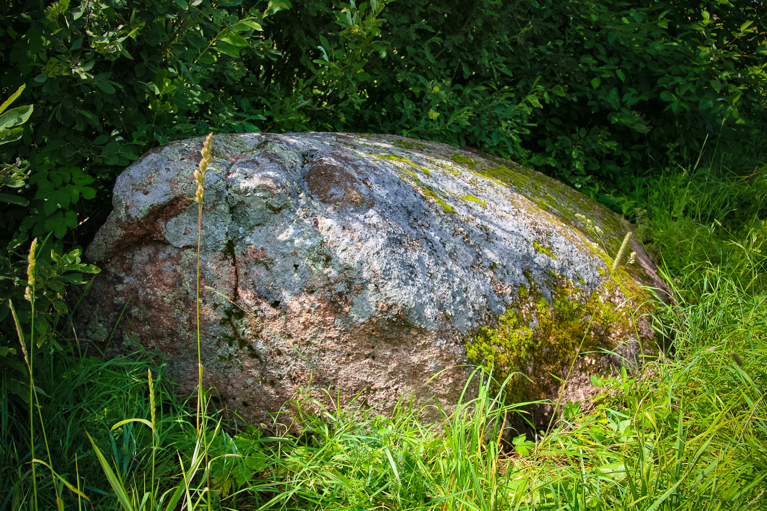
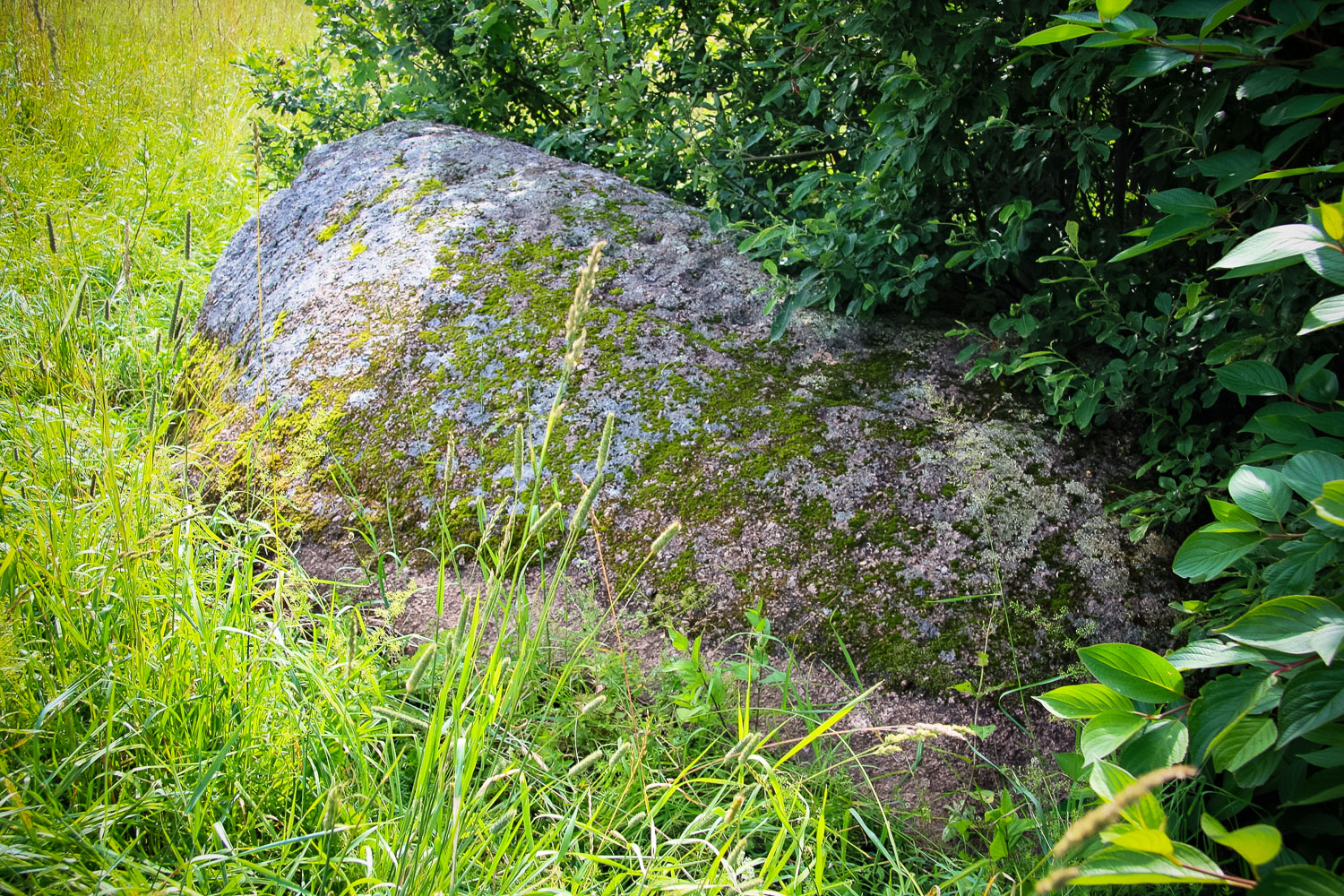
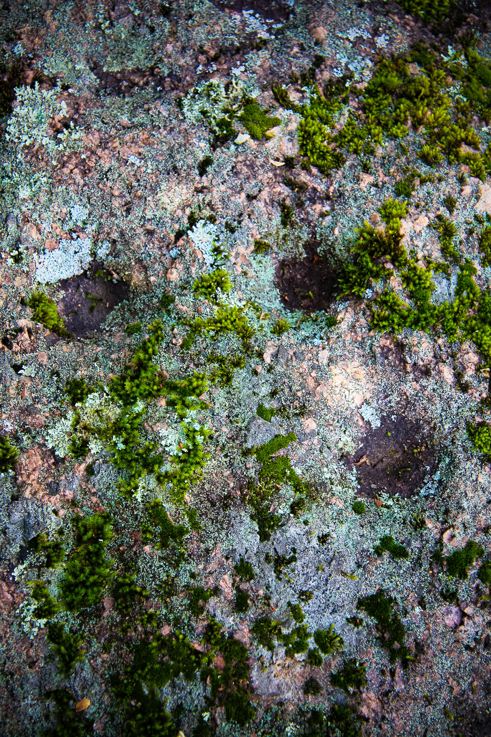
State archaeological heritage (State Inspection for Heritage Protection, No 2456). 3.95 m long, 2.90 wide, 1.10 m high; circumference of 10.90 m, volume of 5 m³. The stone has not been moved. The orientation of the longitudinal axis is 160 degrees which is almost in the N–S direction and corresponds to the direction the glacier moved, consequently, the stone certainly lies in its original location. In 1978 it was discovered by the expedition of Valmiera Local History Museum. Around the stone a cultural layer has been found (1st-2nd cent. of 2nd millennium AD). The Kalnalammiki settlement site. Approximately in the Bronze Age 40 spherical cup-marks were made on the stone surface. Almost all (except two) cup-marks are made on the stone surface facing E. (A. Grīnbergs, 2010) Around the stone there is dark earth where one can find tiny container fragments, mainly from the wheel containers (11th–13th century?). Obviously, here, on the river bank, there was a late iron age settlement. According to Austra Puikāne (residing in the Irbītes homestead, former Arakste Inn, 77 y. old) who was born and grew up in the Kalnalammikas homestead, there used to be a well at the very stone in the valley. During some excavations around year 1936–1937 wooden well rings were found in the earth here. (I. Cimermane, 1979)
Narrative
As it was reported by Ernests Gredzens, in 1930s the stone was inspected by some museum employees from Riga. After their visit the owner of the homestead dug around the stone and found lining rings of a well there. They wanted to roll the stone there, but failed. Later during the land amelioration the workers tried to move the stone, but failed again. The stone is also called Lambita, previously, Metsekula Sacrificial Stone. They say that under the stone there used to be a spring which later disappeared. In ancient times there used to be springs all along the bank of the Rūja River, but they disappeared after the amelioration. (From year 1987 expedition notes by A. Leitis)
Attraction
The stone itself is very expressive, however, it does not stand out in nature – the meadow is overgrown, at the stone there is a big bush behind which it is difficult to see the stone.
Availability
Rather easily accessible, however, the site is difficult to find without the help of local inhabitants.
Infrastructure, management, facilities
No signs, to reach the site the visitor should cross an overgrown meadow. No infrastructure.
Local info
No. Some old worker of the local saw mill could show the site.
Capacity
41 and more
Publicity
Known
Legal Status
Private