Location
State: Latvia
Region: Vidzeme
County: Strenči
Parish: Plāņi
Other references to the location
In the woods, 1 km south-east of the old forest-guard’s house of Gulbīši. One can reach it also from the opposite side by a forest road along the quarter firebreak and then crossing yet a ditch.
Coordinates
lat=57.509984341226, lon=25.905063113064
57° 30′ 35″ N, 25° 54′ 18″ E
Description
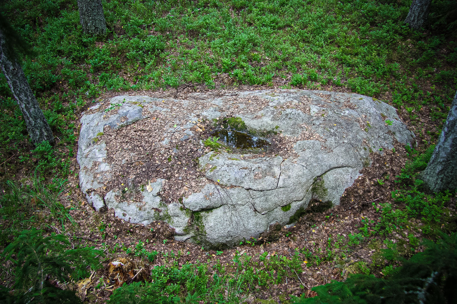
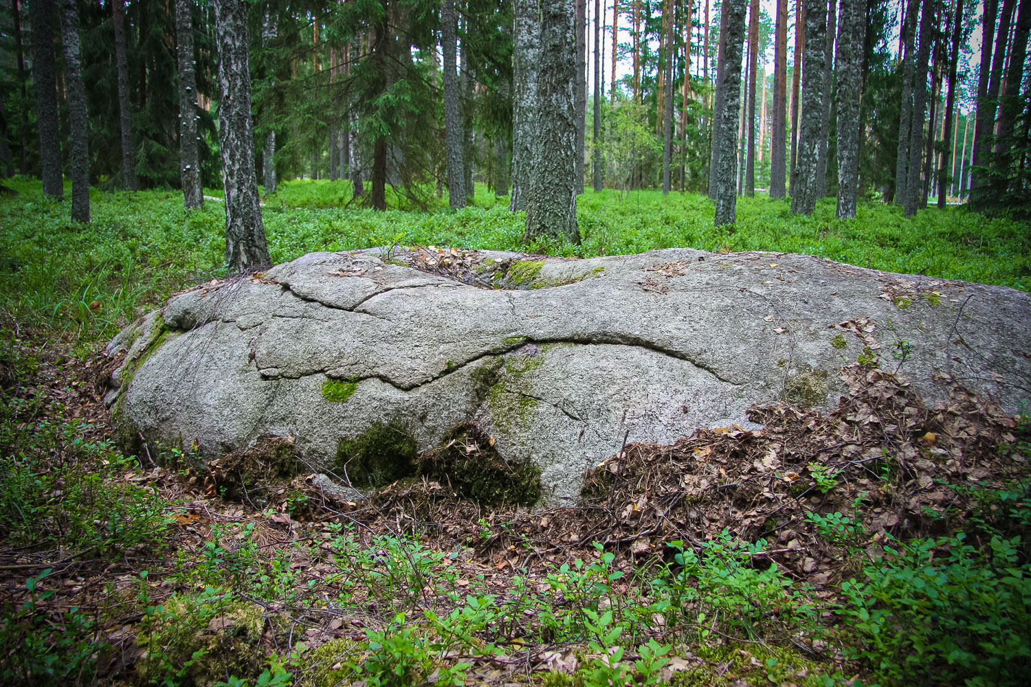
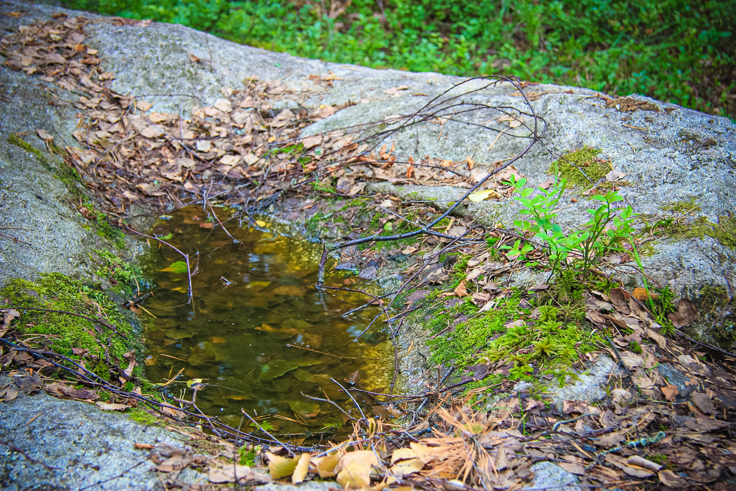
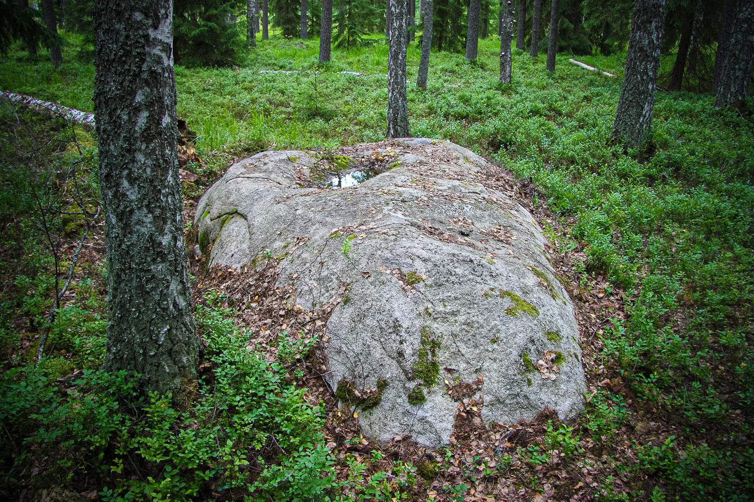
State archaeological heritage (State Inspection for Heritage Protection, No 2382). On the even, slightly sloping surface of the Gulbīši Sacrificial Stone (length of 4.8 m, width of 2.8 m, height of 0.6 m) one can see an artificially made longish hollow (length of 1.3 m, width of 0.6 m, depth of 0.13 m), the sides of which have crumbled a little, because, as evidenced by archive material, in 1919 forest axemen burnt a large bonfire on the stone. The local people have been calling the stone the Sacrificial Stone or the Ancestors’ Stone since ancient times. (Urtāns, 1993) Nearby is the Gulbīši Ancient Burial Ground, Ruķi Fir-Tree, Alksnīši Ancient Burial Ground. Located in the property of the Latvia’s State Forests.
Narrative
They say that the water collected in the longish trough was used for healing eye diseases. In acknowledgement of recovery, they used to throw small coins into the stone trough. This tradition has preserved till nowadays. The black coaly soil at the stone foot testifies about other ancient rituals as well. Minor archaeological excavation works showed that once in the ground there were offerings of organic nature dug. (J. Urtāns. Footprint Stones, Boundary Stones, Trough Stones, 1990 (Pēdakmeņi, robežakmeņi, muldakmeņi.)
Attraction
A stone of impressive dimensions. It is crannied; there is a hollow in the middle of the stone that is well visible and filled up with rain water.
Availability
No indication signs; a local guide’s assistance who has a good knowledge of the surroundings and the location of the stone is much appreciated when looking for the object’s location. At a distance of about 1–1.5 km of the stone, there is an indication sign to the Gulbīši homestead. At the beginning of the path there is a quarter slab 31/32 of the Latvia’s State Forests. The path leads further to the Geide Swamp. One can reach the stone walking 700–800 m along a ploughed up path (occasionally swampy) and 100 m along a break at the ditch (the ditch is a landmark).
Infrastructure, management, facilities
None. In the territory near the stone, there have been no special facilitation or maintenance works performed.
Local info
No information stand. The information has been provided and the path to the stone shown by the propr
Capacity
10 – 40
Publicity
Known
Legal Status
State property
Comments
According to A. Dūmiņa-Heidoka’s narration, “Further on, there used to be the Jurģi Church, from which only a few stones are left. They looked for indications of the church hill, but nothing has been found till now. Previously a district forester with sisters lived in the Gulbīši homestead. They had a servant – an elderly woman who narrated that every Sunday the forester went to the church in the forest with his sisters. The Gulbīši homestead itself was built in 1874 (a mark on the homestead’s foundation).”