Location
State: Latvia
Region: Zemgale
County: Jēkabpils
Parish: Rubenes
Other references to the location
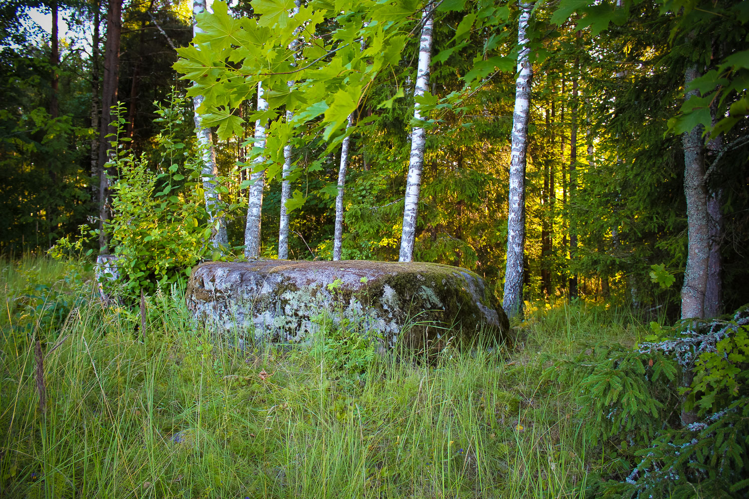
200 m direction W from Kaldabrunas – Riteniski road, 150 m direction SWW-W from the small Dronkas cemetery, on the other side of the field, 5 m away of its edge, in a mixed forest – at its edge. The stone is visible from the cemetery (from its S side).
Coordinates
lat=56.1419444444, lon=26.0755555556
56° 8′ 30″ N, 26° 4′ 32″ E
Description
Dimensions of the stone: 4,2 x 4,0 x 1,2 m, circumference – 13,1m, volume – 14 m3. Medium-grained grey granite. Located in its original position, i.e. It has not be relocated.
Narrative
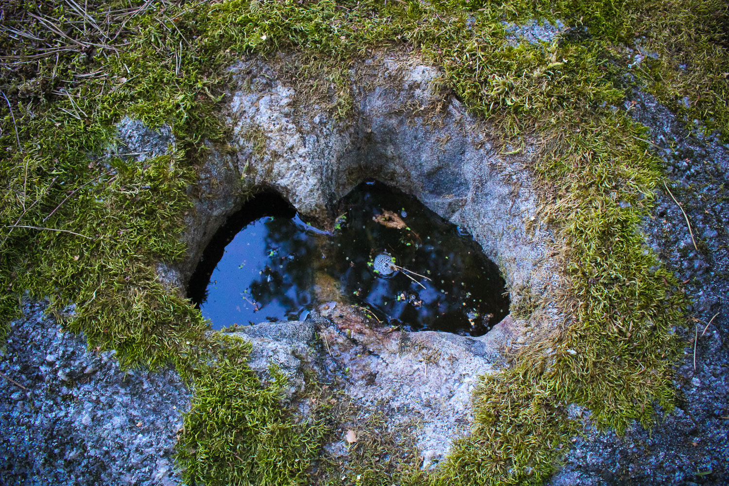
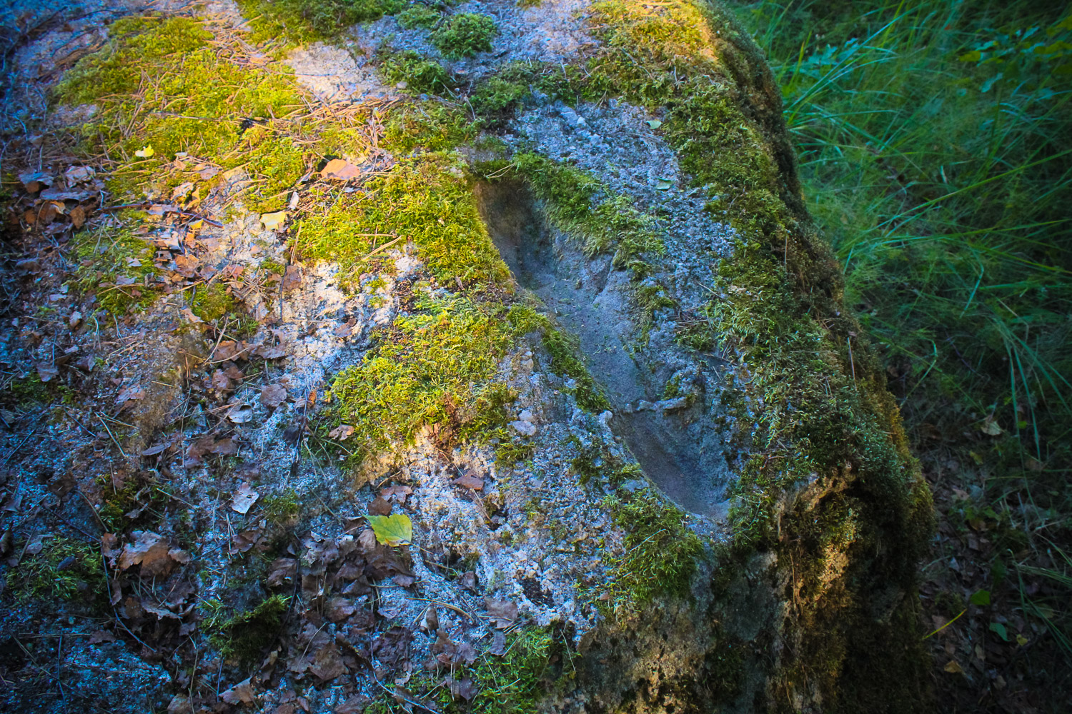
The flat surface of the stone bears two interesting footprints, which as it is said are left by the Devil. The most interesting is the footprint in the shape of Latvia, which is found on the N side of the surface, around 20 cm from a steep edge. The footprint is up to 15 cm deep. „Latvia’s” length – 25 cm, width – 12 to 15cm. The second footprint is located on the W side of the surface, 4 cm from the W edge and 15 – 30 cm from the S edge: the footprint is in total 54 cm long, and it is divided in 3 sections: each 16, 20 and 18cm long; the footprint is in total 9 cm wide; depth: upper part – 6 – 7 cm deep, middle – up to 2cm deep, lower part – 5 – 6 cm deep. Usually there is no water in this footprint, while there is always at least some in “Latvia”. The stone bears minor cracks, but no carvings. The water accumulated in the Devil’s Foot was deemed healing.
Attraction
Rather well-shaped secular stone. Especially interesting is the Devil’s Footprint in the shape of Latvia.
Availability
Partly hard to access – a meadow, ancient burial ground, another meadow, which may be more or less difficult to cross depending on the season, shall be crossed. In 2011 the meadow has started overgrowing with bushes.
Infrastructure, management, facilities
No tourism infrastructure in direct vicinity. Nearest town – Akniste, where one shall find tourism infrastructure: a shop, a catering site, and some sightseeing objects.
Local info
No information.
Capacity
10 – 40
Publicity
Known
Legal Status
Private
Comments
On the East and North of the stone there are several pits left by “gold diggers” from different periods of time. On the Jekabpils district map (Jana Seta, Riga, 2010) the stone is marked on the opposite side of the cemetery. Not far from Dronku cemetery there is the Lake Dronku, which is also mentioned in many legends. On the Southern bank of the lake there is a hillock, which is called the God’s Garden (J.Urtans. Lakes of Upper Latvia. Riga, 2008). There is the ancient burial ground of Ezerini and Dronku settlement in the vicinity.