Location
State: Latvia
Region: Vidzeme
County: Vecpiebalga
Parish: Taurene
Other references to the location
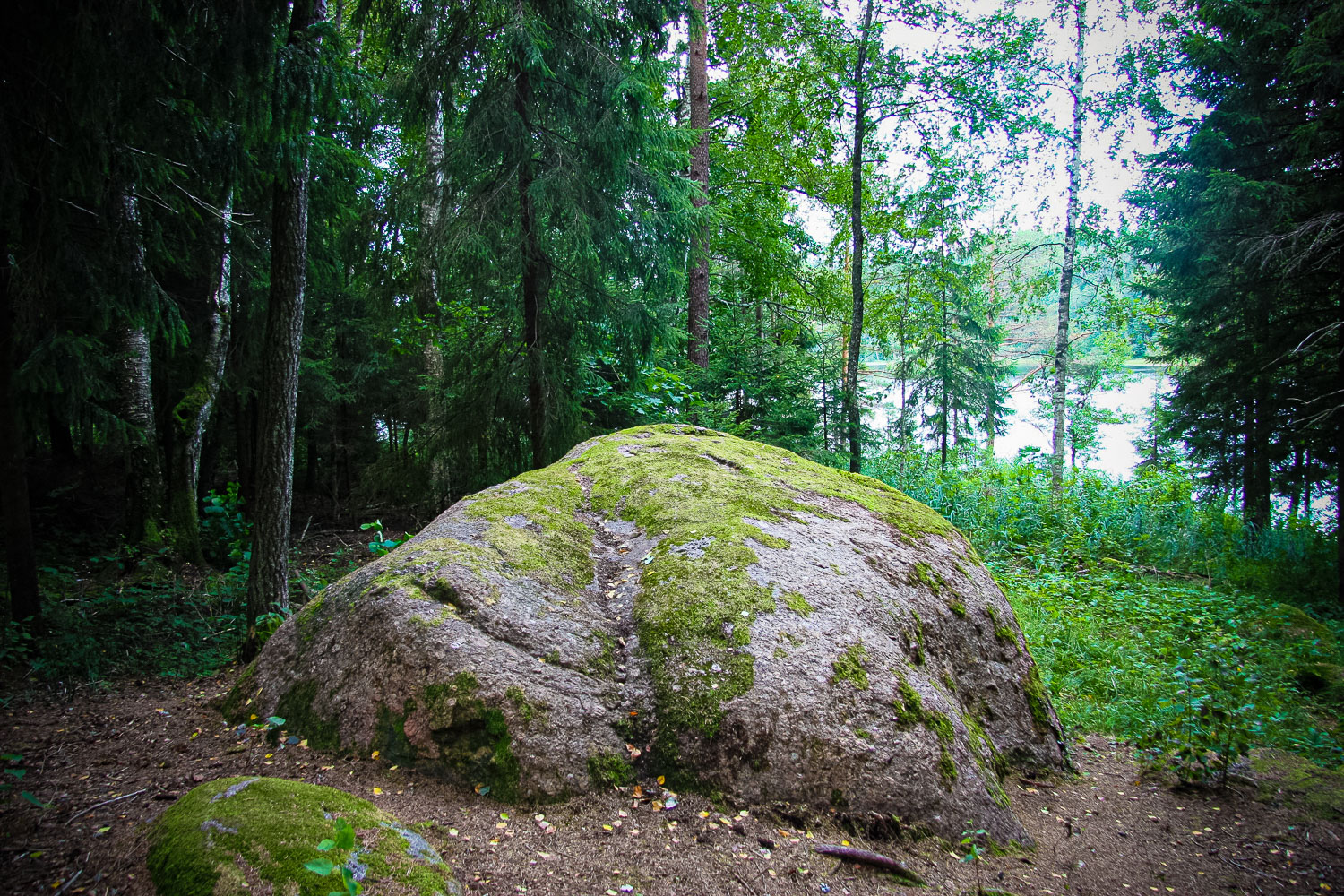
It is situated on the north-east bank of the Bānūži Lake.
Coordinates
lat=57.150319127537, lon=25.585482516111
57° 9′ 1″ N, 25° 35′ 7″ E
Description
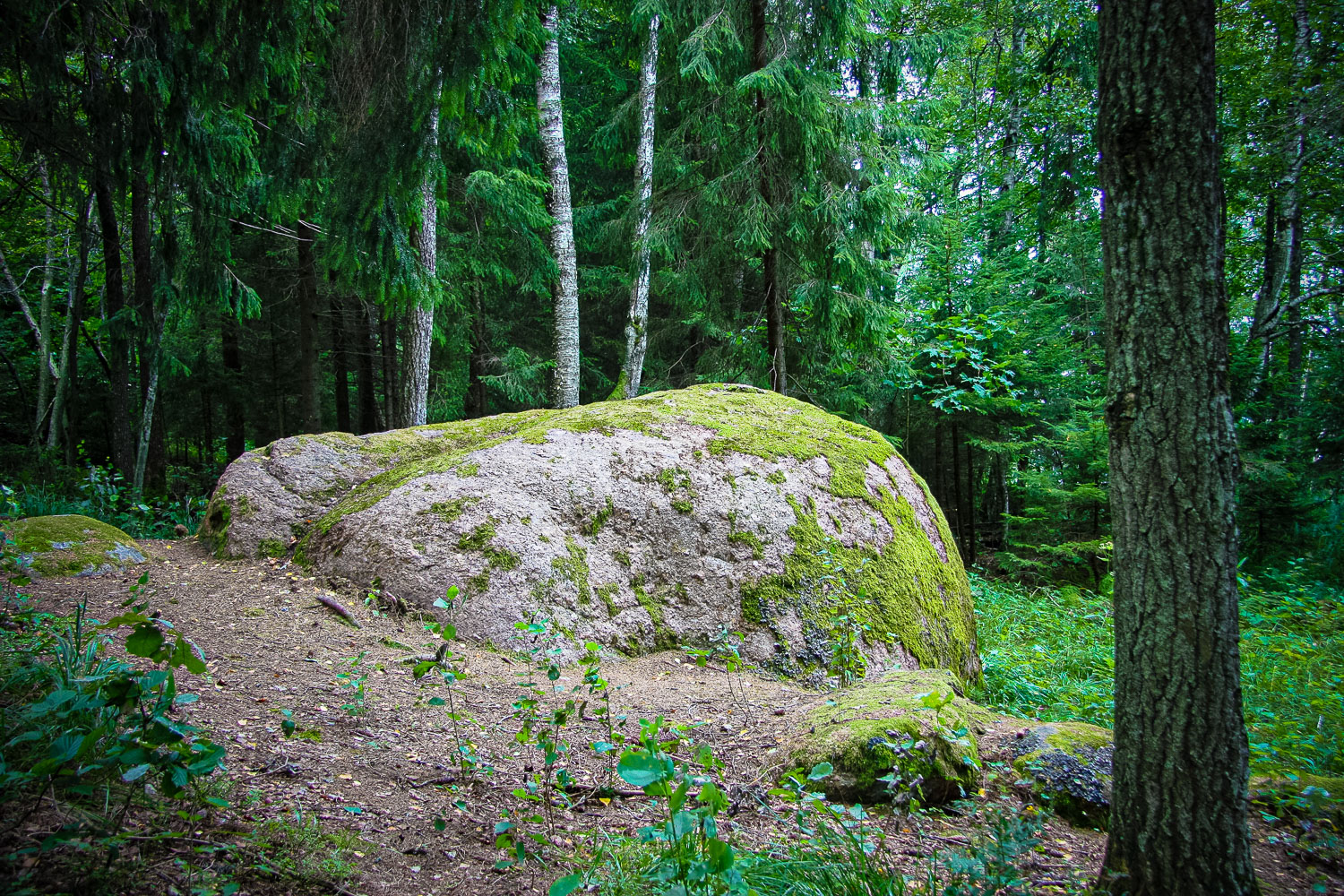
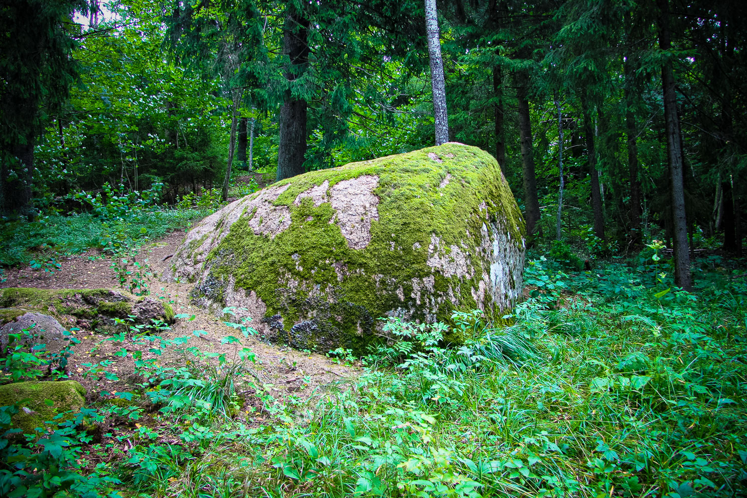
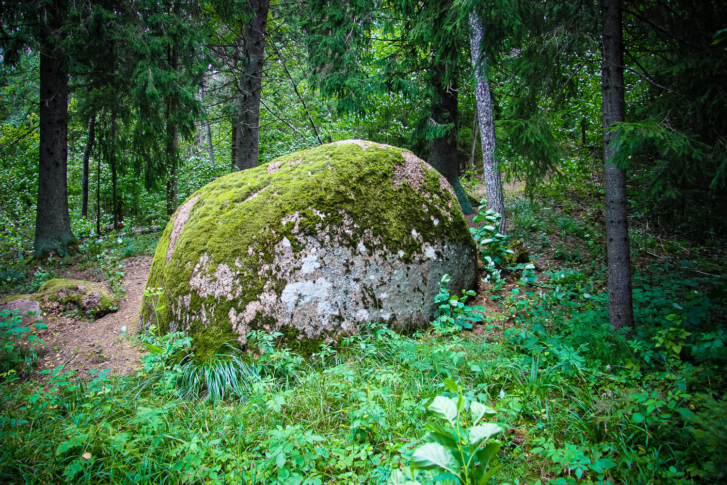
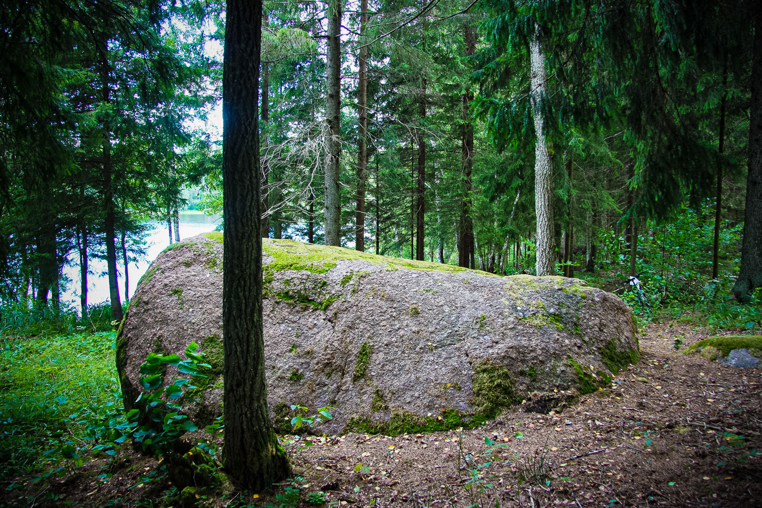
Local archaeological heritage. It is located in a small cape that towers scenically above the Bānūži Lake for more than several meters. The cape has many springs and it is wet. A huge impressive stone, slightly overgrown with moss. The dimensions of the stone: height in the southern part against the lake is 2.22 m, length — 4.40 m, width (at the foot) — 4.5 m, width (at the surface) — 3 m, circumference — 15 meters (Municipality of the Vecpiebalga County, 2012). Situated in the woods. Nearby is the Liv Settlement, Bānūži Holy Spring, Lower Liv Ancient Burial Ground (Lejaslībiešu senkapi), Jānis’ Hill (Jāņkalns), Lode (Apši) Lutheran Church.
Narrative
No recorded folkloric material has been found until now. The local people know nothing to tell about the object.
Attraction
The stone is worth seeing.
Availability
There is the brown sign, which just like the driveway is hard to notice at once when driving from the Bānūži side. A well visible slightly steep path leads to the stone. The object is easily accessible and visible already at a distance from the beginning of the path.
Infrastructure, management, facilities
Except for the path that has been trodden anyway and the driveway that has been overgrown with small grass, there is no other facilitation, and, actually, there is no need for it.
Local info
There is no information stand. The proprietor of the nearby Stūrīši homestead could not tell anythin
Capacity
41 and more
Publicity
Known
Legal Status
Private