Location
State: Latvia
Region: Riga
County: Kandava
Parish: Zemīte
Other references to the location
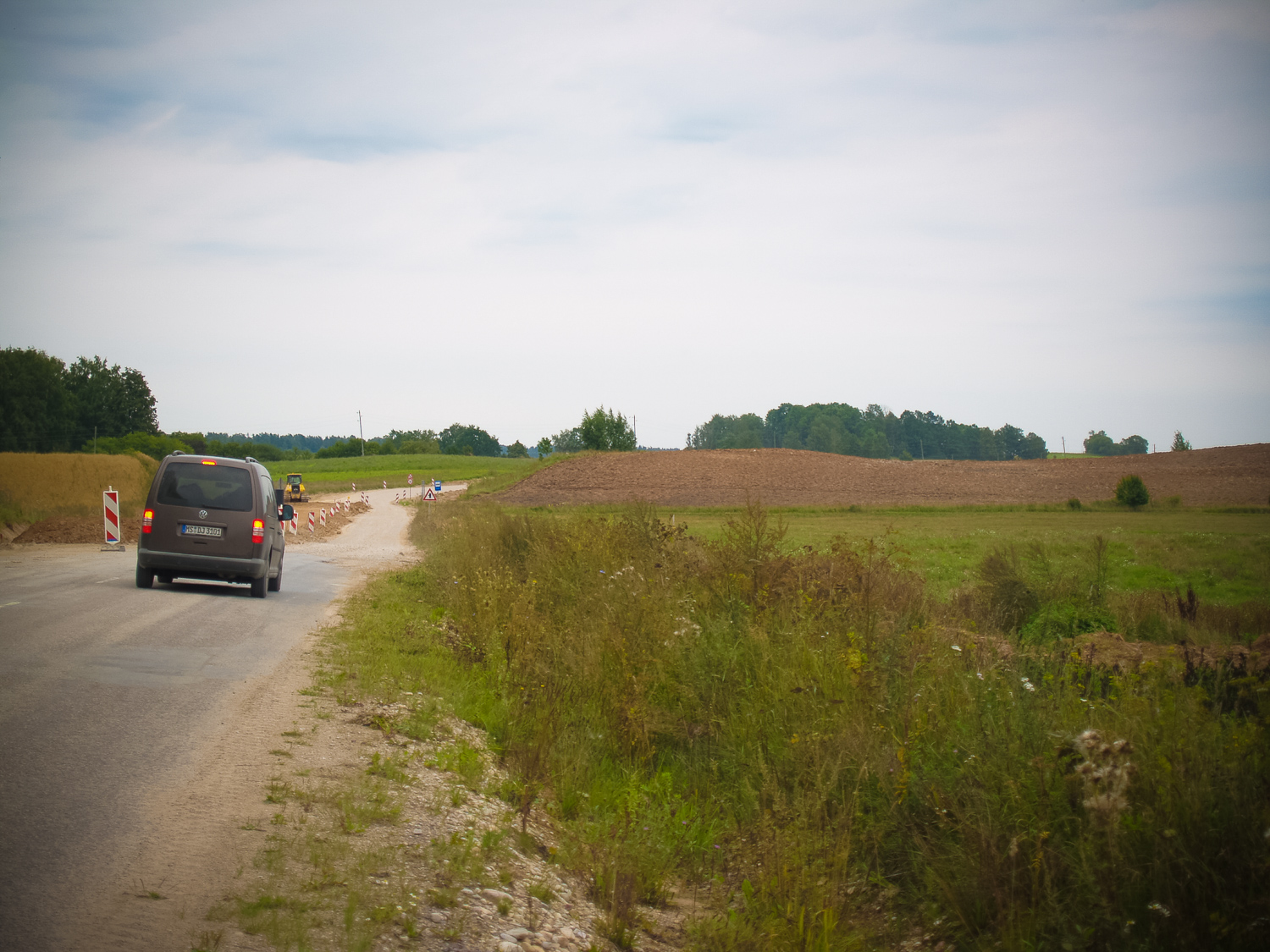
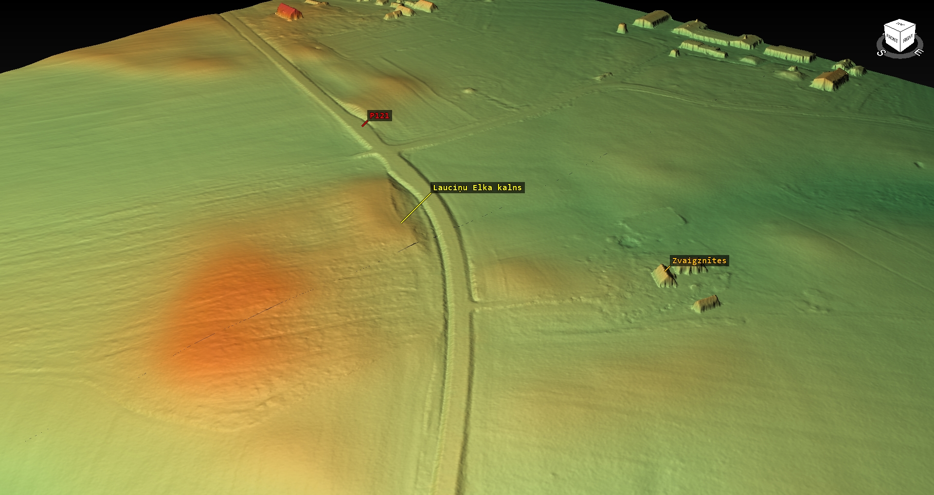
On the right side of highway Zemīte – Tukums between the Zvaigznītes and Lauciņi homesteads, around 300 m SE/E from Zemīte rectory.
Coordinates
lat=56.9233333333, lon=22.8169444444
56° 55′ 23″ N, 22° 49′ 0″ E
Description
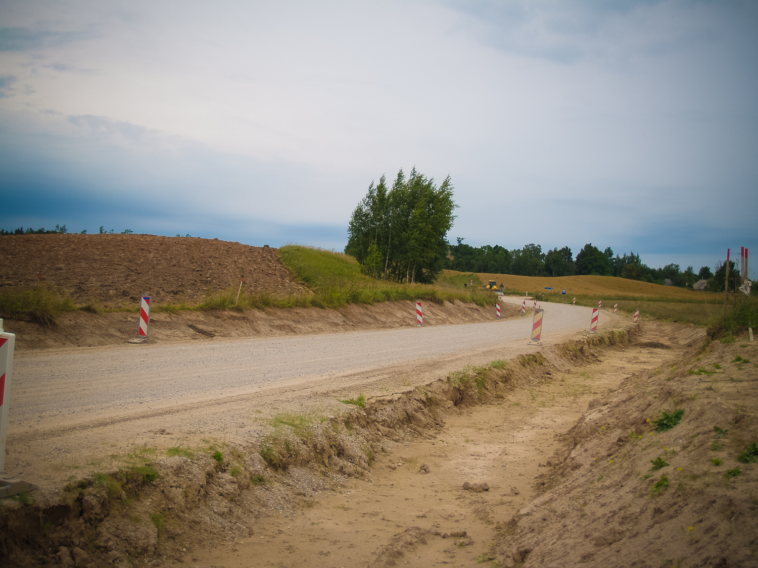
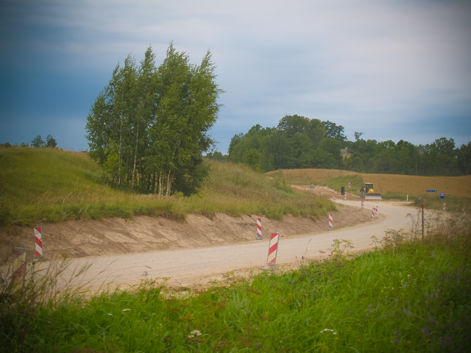
Still around World War I the hill was covered with bushes, then the bushes were cut and the ploughing of the hill was started. In earlier times the hill was very steep towards the road; it was difficult to plough the hill with a horse and therefore the hill was levelled. During the ploughing and digging human bones were found there. Later, at the beginning of 1960s, the Idol’s Hill was demolished during the straightening of Zemīte – Tukums highway. Bones were found again this time. The Idol’s Hill is a wide, loaf-type, gently sloping, relatively triangular, NW – SE oriented and 200 m long and around 100 m wide relief elevation which surmounts the surroundings by approximately 10 metres. The hill is cultivated for agriculture purposes; the plowing shows the evidence of clay in the soil. During the rabotage excavation of the side facing the highway no earlier archeological evidence was found. There are legends connected with the Idol’s Hill about ghosts, strange facts and evil spirits. The sacred character of the Idol’s Hill is evident in its name.
Attraction
Unattractive
Availability
On the road side
Infrastructure, management, facilities
None
Local info
None
Capacity
0 – 9
Publicity
Unknown
Legal Status
Private
Comments
At the moment of inspection reconstruction works were taking palce on Zemīte – Tukums road. A bulldozer had planed the assumingly previously levelled N slope of the Idol’s Hill. There was grey earth; no archaeological evidences could be found. The hill surface was plown; there were no archaeological evidences there either. Along the road there was a deepened road-side ditch. On its surface there was mixed grey earth and deeper – undisturbed clay.