Location
State: Latvia
Region: Vidzeme
County: Smiltene
Parish: Bilska
Other references to the location
Nearby is the Mēri manor house and a park.
Coordinates
lat=57.475864552559, lon=26.033066105957
57° 28′ 33″ N, 26° 1′ 59″ E
Description
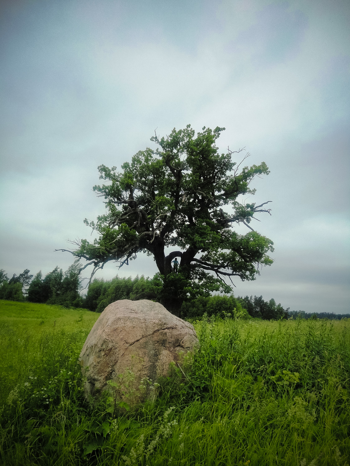
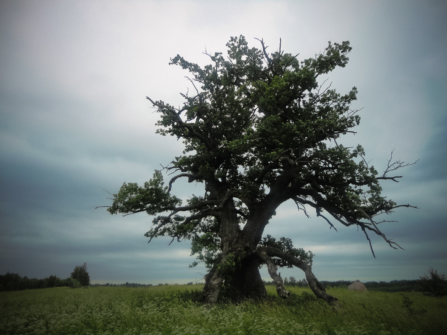
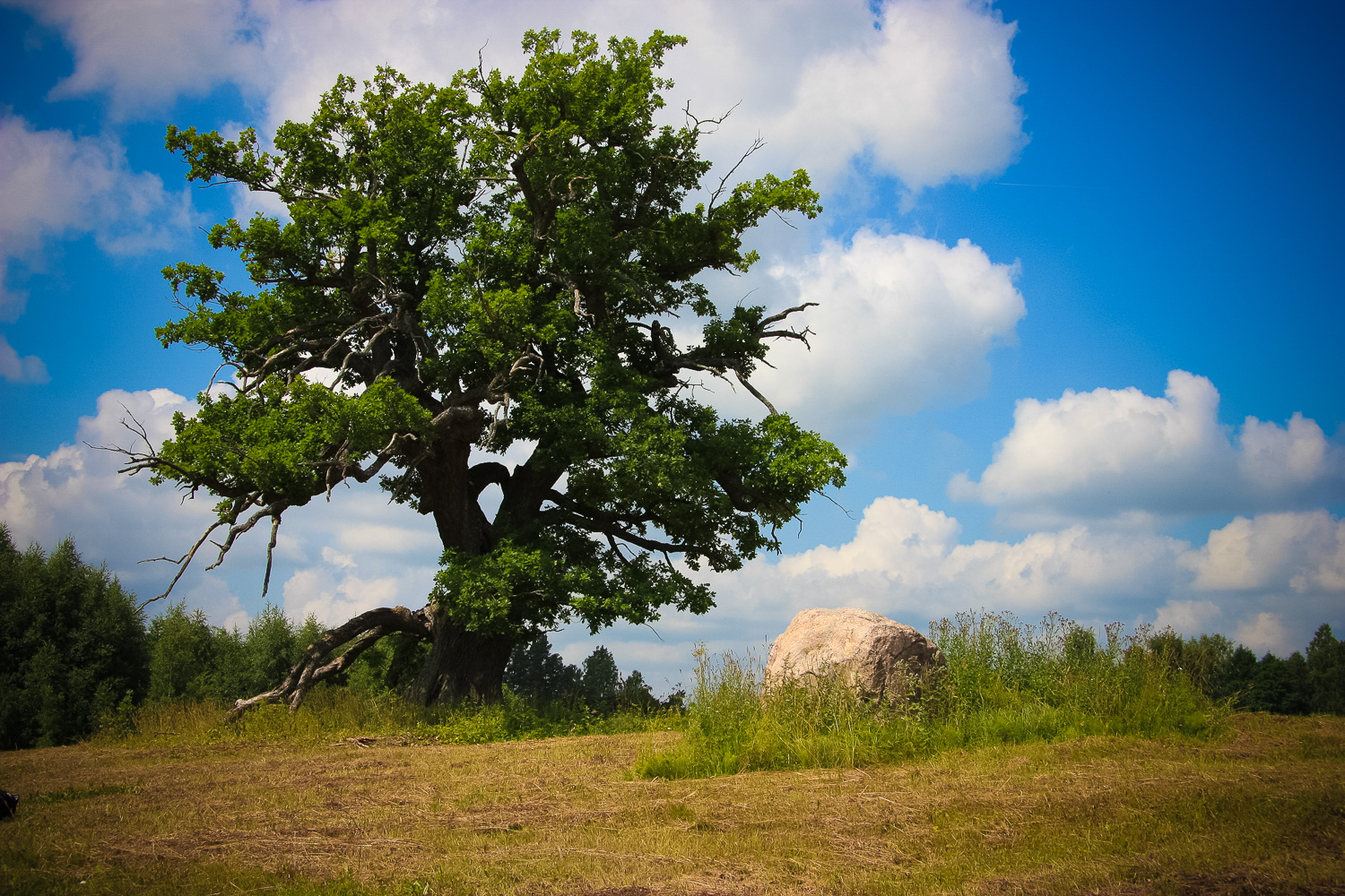
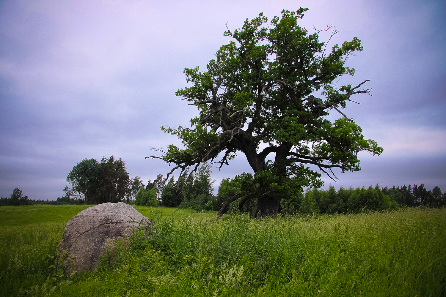
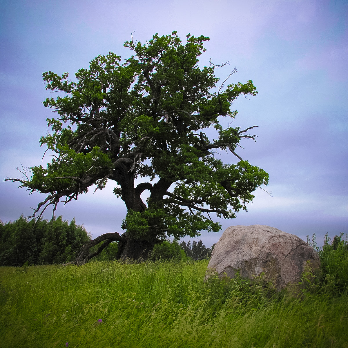
In 1994 it was included into the list of state archaeological heritage as an ancient cult site (State Inspection for Heritage Protection, No 2341). News about the Kalnaegles Oak was published for the first time by Andris Ziemelis in the journal “Jaunā nedēļa” in March 1926, but a biolgosit Edvards Jansons indicated the circumference of the oak’s trunk in the 4th issue of the journal “Daba un Zinātne” of 1937 — at a height of half a meter above the ground it was 5.7 meters. In 1977 the oak was included into the secular tree list as nature heritage. Its age is 300 years. (G. Eniņš. 100 Most Secular and Holiest (100 Dižākie un svētākie). 2008.) Nearby is the Pārkalne Money Stone, the Mēru manor house with a park, the Bilska Lake, the Sūcis Lake and the Mēru Lake.
Narrative
In former times the local elderly people called the Kalnaegles Oak the “Grand Father”, they brought flowers to it. Nowadays the oak is useful for forecasting the weather, namely, one can tell the weather according to leaf blooming and falling. “They used to bring flowers to the oak in ancient times. Oak leaves, acorns, and bark were used for healing those afflicted.” (Latvian National Museum of History, Smiltene Parish. Report by H. Skujiņa, 26.09.1928.) “Near the Egļi-Velde homestead of the Smiltene Parish there is an old, large oak called by elderly people the Grand Father. At the oak they used to sacrifice in former times. Nowadays it is useful for weather forecasting. If in autumn the oak’s leaves do not fall for a long time, the next spring would be late.” (H. Skujiņa, Smiltene Parish)
Attraction
The object is quite easily noticeable from a distance. Next to the oak there is a rather large stone. Across the road in a meadow one more oak is growing that is smaller and looks younger. Not far fro
Availability
No indication signs. The landmark is the indication sign to the homestead “Ceriņi”, from which there is a turn to the right. At a distance of about 1 km from the oak, there is the Kalnaegles Hill Fort (it is marked in the map of “Jāņa sēta” of the Valka District scale 100.) that it is overgrown with trees and nettles; a cornfield and a meadow are around it where currently the grass is at a human’s height. It is visually difficult to notice the hill fort, it is not very high, only the trees growing on top of the hill fort are visually taller. An unpaved road leads to the Kalnaegles Sacrificial Oak, currently it is obstructed by broken branches of a pine-tree.
Infrastructure, management, facilities
The grass around the oak and the stone is mown, but the objects themselves have slightly grown into the grass (it is not possible to mow so closely). No other type of infrastructure or facilitation.
Local info
On the site there is no information about the oak. The closest homestead is located at about 1.5 km,
Capacity
10 – 40
Publicity
Unknown
Legal Status
Private