Location
State: Latvia
Region: Vidzeme
County: Amata
Parish: Drabeši
Other references to the location
On the right bank of the Amata River, not far from the Jaunīļaki homestead
Coordinates
lat=57.227631307712, lon=25.232290381931
57° 13′ 39″ N, 25° 13′ 56″ E
Description
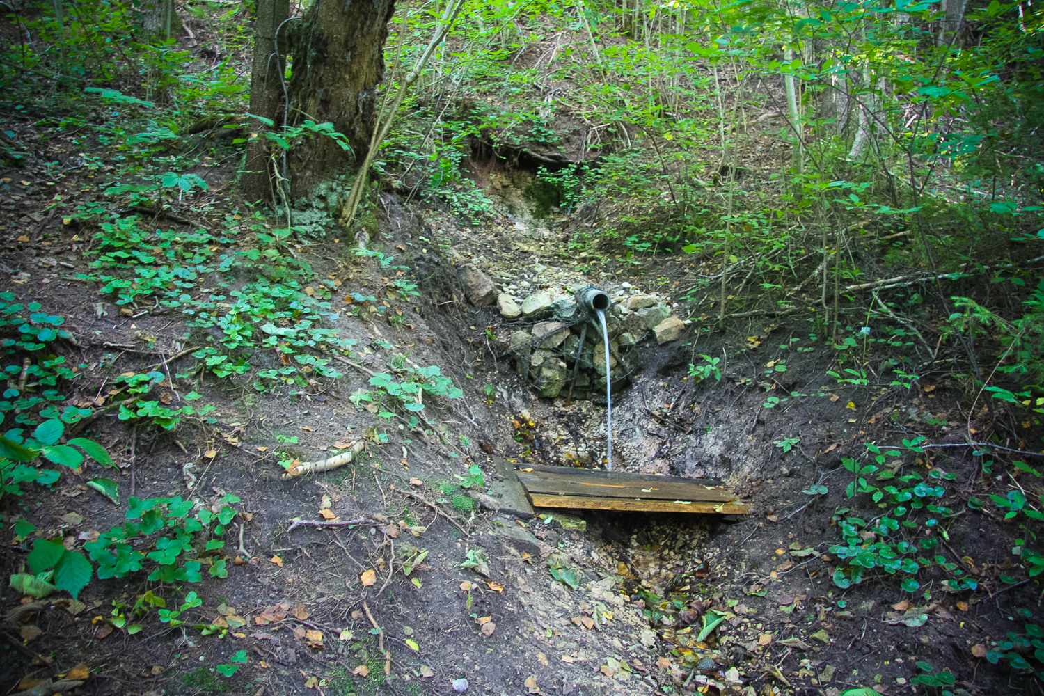
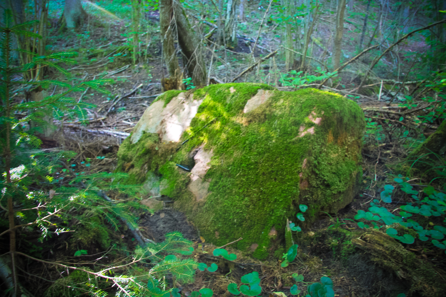
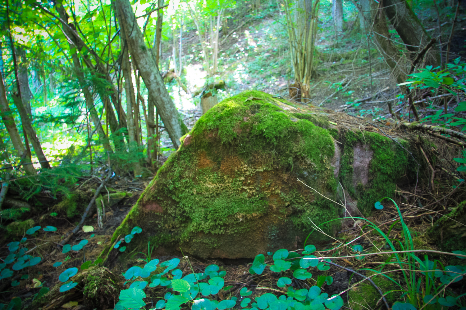
3 springs start from a rather steep slope here. The most powerful one which lies closest to the Riga highway provides in average 10 litres of water per minute. The other two are not so productive. Their power could be estimated as average 2 litres per minute. It might be that under a huge pressure another small spring finds its way through the gaps in the rock. Unfortunately the strongest spring has been locked in a pipe which considerably decreases the healing properties of its water. About 30 m W from the most powerful spring there is a sacred stone with dimensions 1.0 x 0.6 x 0.3 m. It seems that in ancient times the stone was intentionally processed to make its surface even. On the stone there is a shallow hollow of approximate size 10 x 5 cm necessary for seer activities. The stone leads to the thought that there were specific activities which were not practiced directly at the spring (Vīks, ER).
Narrative
No recorded folklore materials have been found up to now. The local people cannot tell anything about the site.
Attraction
Several springs, each of them different. The banks of the spring have eroded; next to it there is a barbed wire to prevent the people willing to take water from accessing the spring in the wrong place
Availability
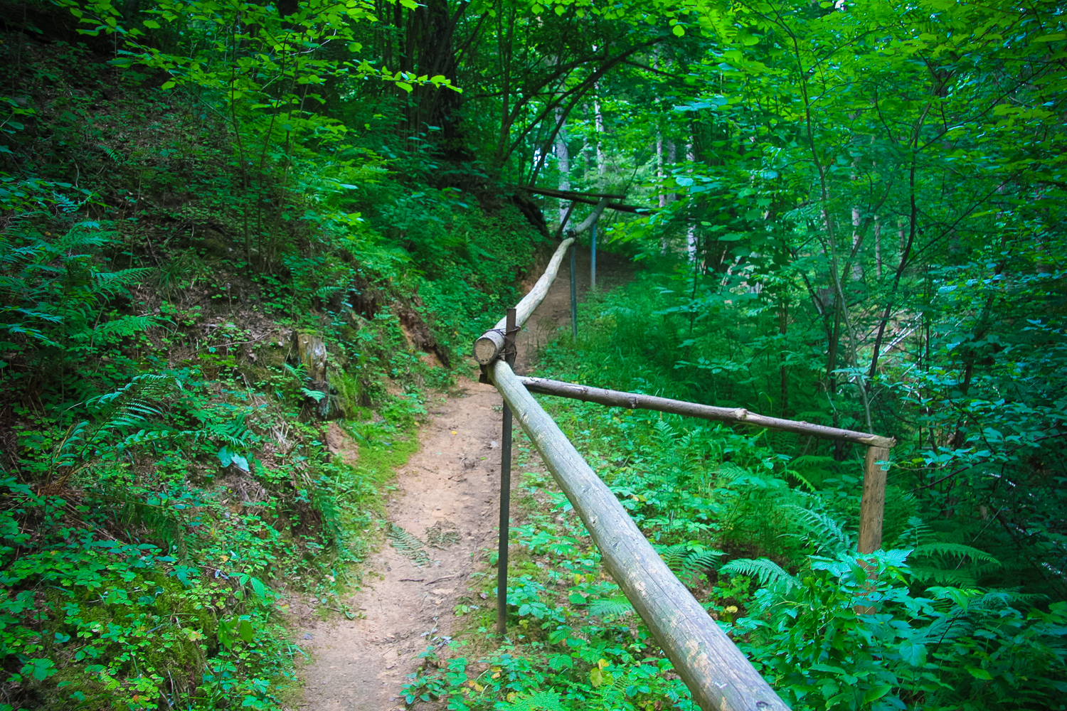
In the Internet there are several confusing descriptions about the accessibility of the site in connection with Īļaki homestead. One should be guided by the river bank. There is a rather good path leading to the spring directly from the highway A2.
Infrastructure, management, facilities
Partly facilitated for taking water
Local info
No
Capacity
0 – 9
Publicity
Known
Legal Status
State property
Comments
It is used as a water acquisition site.