Location
State: Latvia
Region: Zemgale
County: Kokneses
Parish: Kokneses
Other references to the location
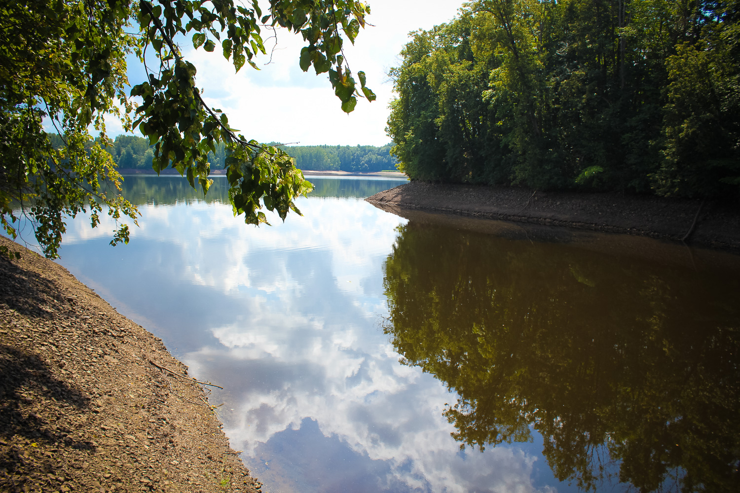
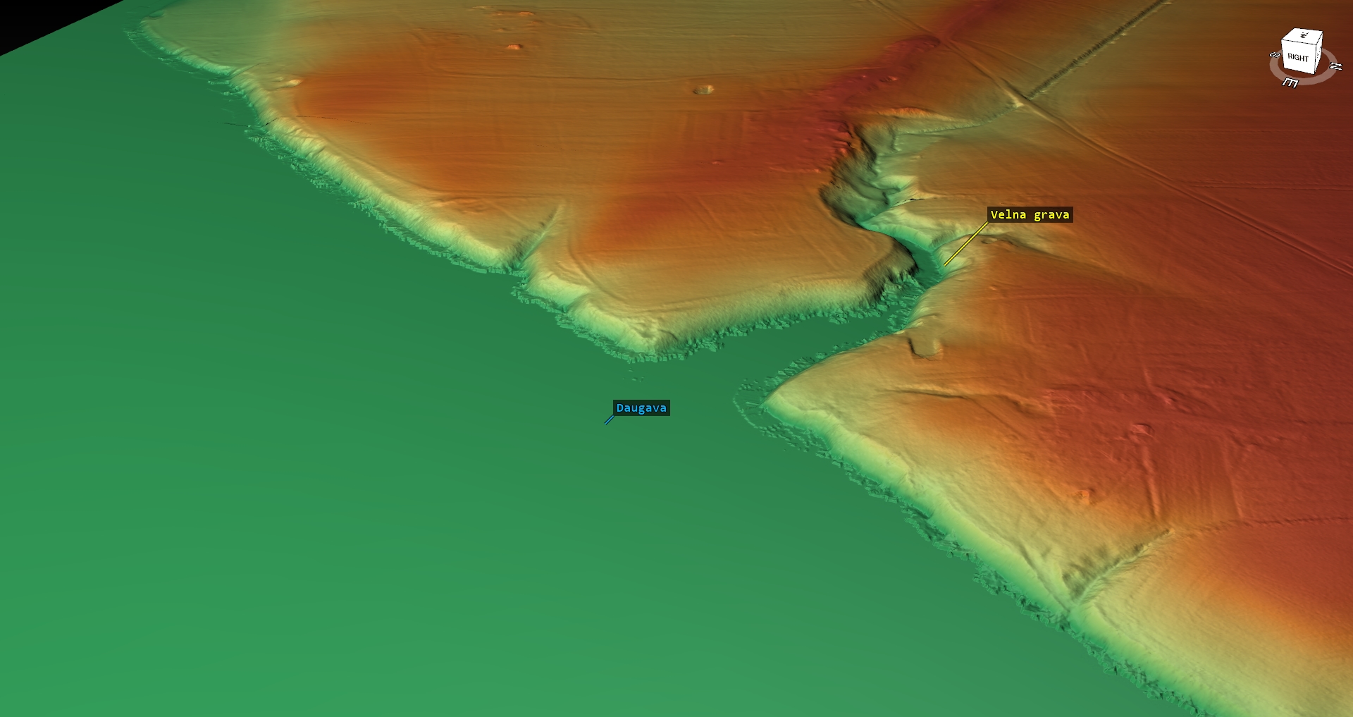
Ravine on the right bank of Daugava, between the “Lazdas” and “Kikaukas” homes.
Coordinates
lat=56.6004335067, lon=25.3219020942
56° 36′ 1″ N, 25° 19′ 18″ E
Description
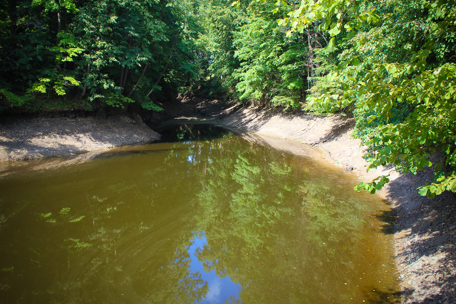
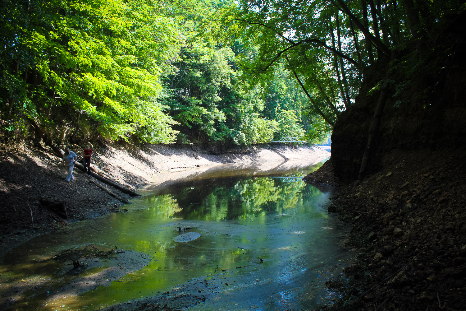
Once it was a large ravine in the shape of a canyon. After the Plavinas water power-plant was built, the ravine was partly flooded and only its upper part is now visible, which still is rather impressive. Dolomite cliffs are seen in the ravine. When the water level is lower, also the spring is seen.
Narrative
The ravine bears a mythological name – Devil’s Ravine. It is said to have been mentioned also in the tales. Probably, an ancient cult or mythological site.
Attraction
The ravine is interesting, although most of it is flooded.
Availability
Access is partly complicated.
Infrastructure, management, facilities
No tourism infrastructure. Nearest town – Koknese, where the Koknese castle ruins, Liktendarzs/ The Fate Garden (in 2011 it is not yet finished), Koknese park and manor buildings and other objects found. There are shops, accommodation sites and a tou
Local info
No information.
Capacity
41 and more
Publicity
Known
Legal Status
Private
Comments
Indicated on the layout in the encyclopaedia “Nature of Latvia” (1997, p. 160).