Location
State: Sweden
Region: Gavle
County: Gävleborg
Parish: Enånger
Other references to the location
Along the road between Enånger and Långvind
Coordinates
lat=61.492321674247, lon=17.009925050813
61° 29′ 32″ N, 17° 0′ 35″ E
Description
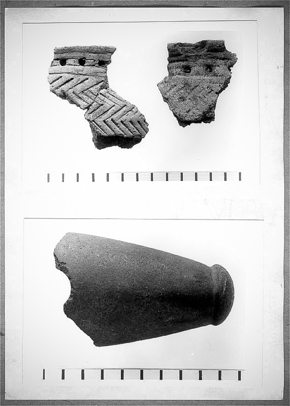
Cult place during the Late Stone Age.
Narrative
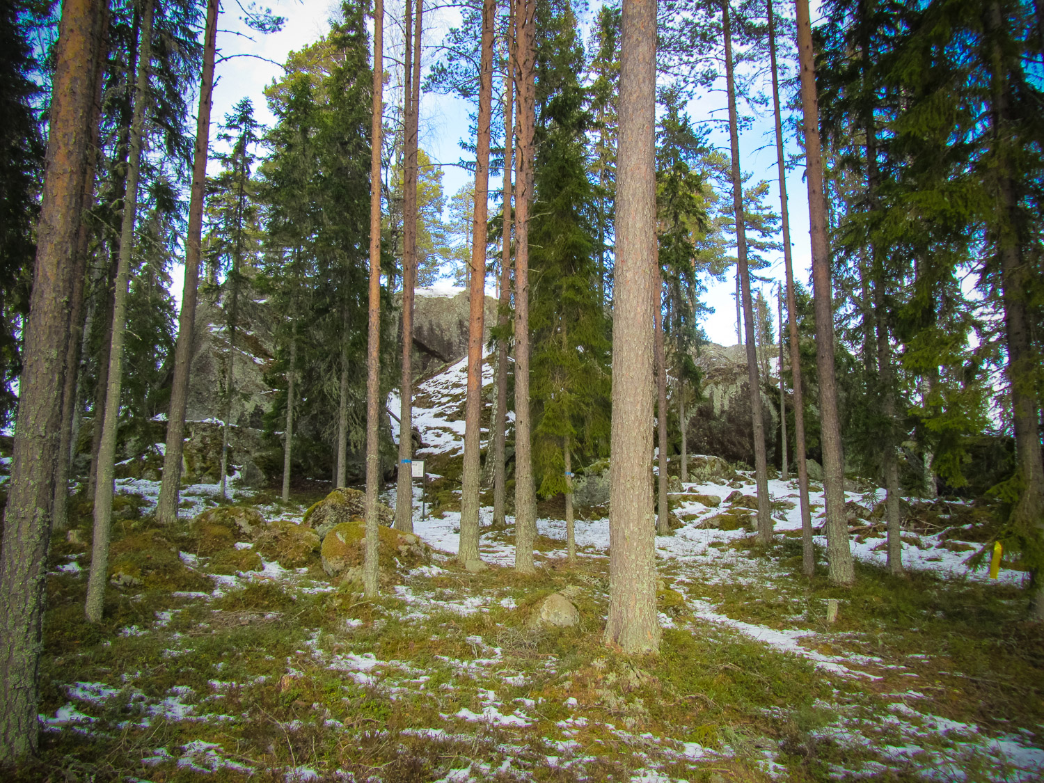
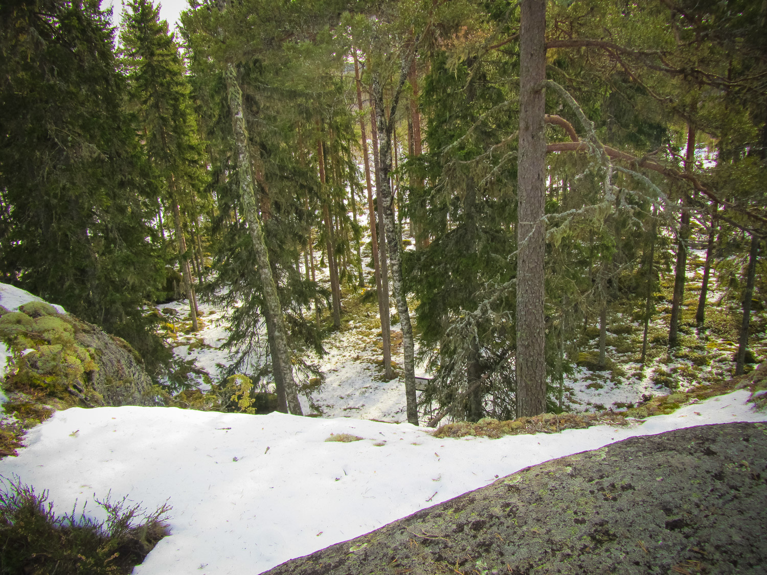
The site is situated on the top of a large cliff in the forest. During the Stone Age, it was surrounded by the Baltic Sea. People from around the Baltic Sea met here to perform cult acitivities. In the rituals, they have destroyed several stone axes of different kinds.
Attraction
Mystical forest environment and an ancient holy site
Availability
Car, then a 1100 m walk. If you want to go up on the cliff, you have to climb a ladder.
Infrastructure, management, facilities
No infrastructure on the site
Local info
Old county museum sign
Capacity
41 and more
Publicity
Popular
Legal Status
Legal Entities
Comments
It is strictly forbidden to remove artefacts from the site!
You might also like