Location
State: Latvia
Region: Zemgale
County: Aknīstes
Parish: Aknīstes
Other references to the location
In the lower reaches of the right tributary – River Radzupe (21km long) – of the River Dienvidsuseja, on the left bank, 1 km direction NE from town Akniste, opposite of “Kalkucepli” home, around 2 m above the water level of the river.
Coordinates
lat=56.169840, lon=25.769520
56°10’11.4″N 25°46’10.3″E
Description
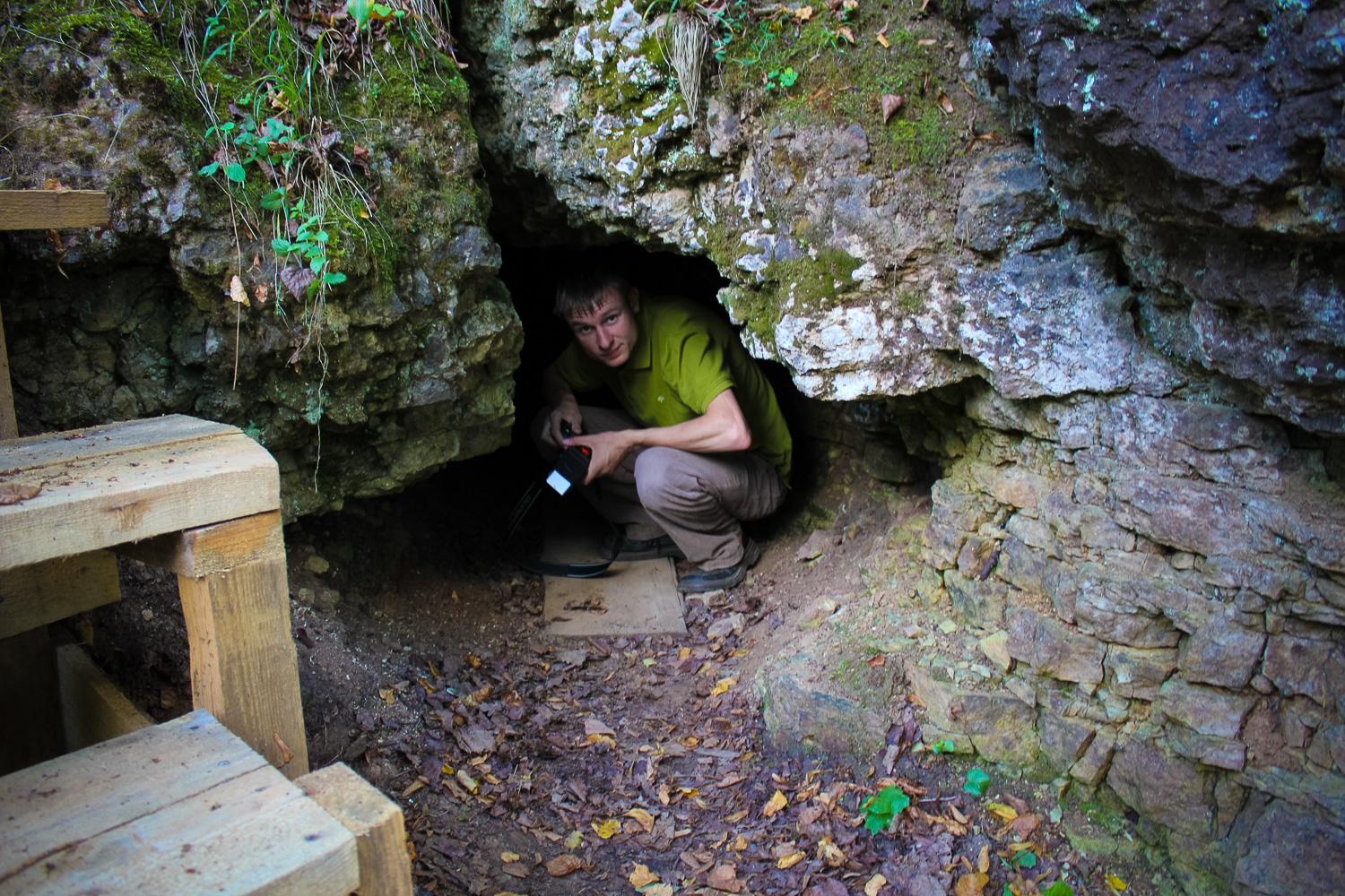
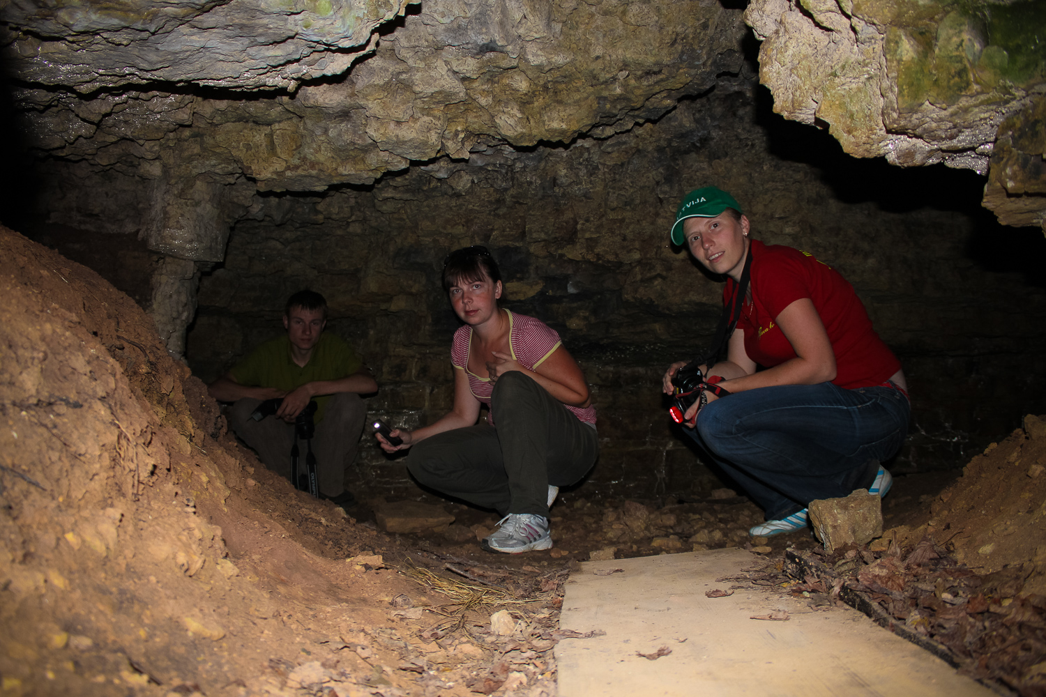
The cave is artificial, 5 m long, 1,2 m high and up to 5,1 m wide, the underground area reaches 13 m2. The cave has been created by mining rocks for the need of lime-kilns, probably, in the 19th century. Most probably, the name “Devil’s Cave” is rather recent – from 20th century. There is an opinion even that the title has been widely used only since 1990ties and was invented by children. At least the stories originate from that time, since there are no ancient legends or stories about this cave.
Narrative
During WWI and the Soviet repression period people have hidden in the cave. Unfortunately the name – Devil’s Cave – is a modern one, and it is not deemed a cult site. The name – Devil’s Cave – was first published in 2001 (tourism brochure “Zemgale”; published by Bauska District Tourism Association).
Attraction
Average.
Availability
Rather easy accessible.
Infrastructure, management, facilities
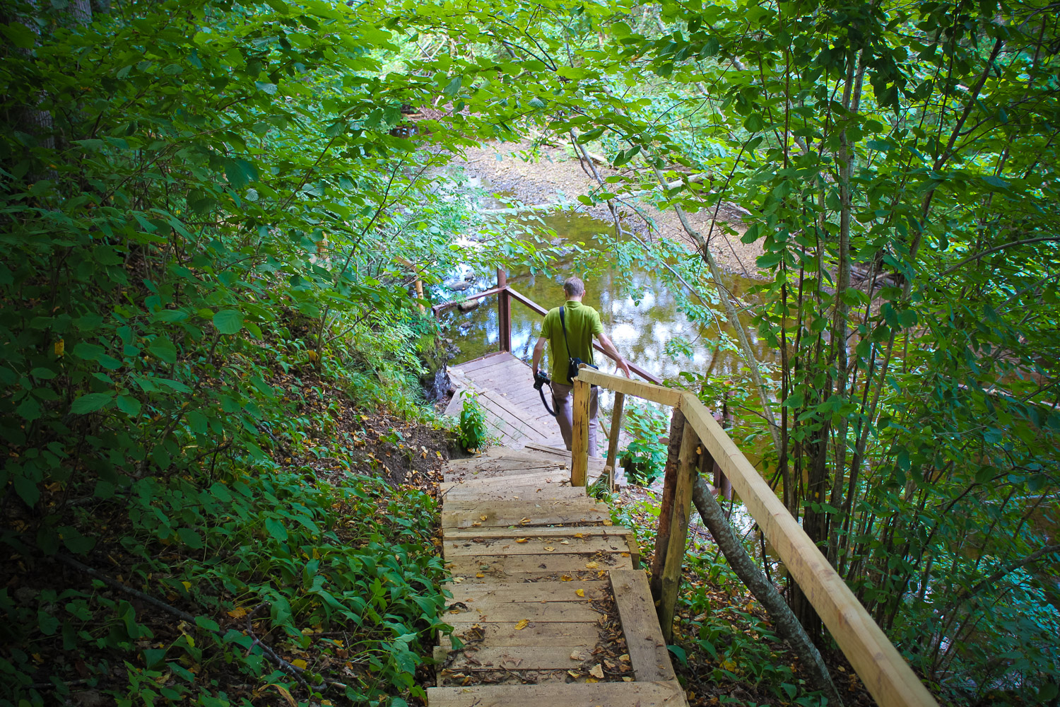
Signs in several places. The cave is facilitated – stairs and railings along the riverbank. The signs use the name “Devil’s Cave”. A small recreation area has been established – a wooden table and benches, a campfire place have been installed. Visito
Local info
Besides several signs, at the cave there is no information about it. Staff from the Akniste Local Hi
Capacity
0 – 9
Publicity
Known
Legal Status
Private
Comments
The outcrop at the cave is 15 m long and up to 2 m high. Probably the cave is natural (early stage erosion or a natural crack), but has been extended in the modern times due to extraction of dolomites. More common since 1974, when a photo was published in the photo album by M.Kundzins – “Rivers of Latvia”; the first known photo is from summer 1929 (stored in Akniste Local History Museum, and the description of the cave does not call it a Devil’s Cave). Longest trail within the territory of Zemgale Planning Region and Selonia.